Showing posts with label Motorcycle Touring in Sumatra. Show all posts

Friday, July 6, 2012

The Journey South (Part 4)


My route through Bengkulu.  Map from provincial RTRW.

When we last left our hero (yours truly) he was being screwed around by district officials in Arga Makmur, the capital of Bengulu Utara (North Bengkulu) district.  I was in Bengkulu Utara as part of a 2-week road trip through several provinces on Sumatra to visit villages, collect planning documents, and meet with government officials about the relationship between Kerinci Seblat National Park and the political entities surrounding the park.  This trip is part of my PhD dissertation research, which I've been in the field working on for the past 10 months.  I'd been told after waiting around for the vice district head to come to the office at 8am the following day, when I would be allowed to interview him.

Moving Right Along...


One of my new friends at Bupati's office in Lebong
The next day I went to the office as per the instructions.  After waiting about 30 the vice district head's secretary came in and told me he'd been suddenly and unexpectedly called away to a "party" and that I wouldn't be able to meet with him.  She apologized profusely while I made haste for the exit, intent on getting back on the road for possible greener pastures in Muara Aman, the capital of Lebong district.  After packing it took me about 2 hours to motor over to Muara Aman, where having no friends I checked into a room and headed up to the political and cultural affairs office (KESBANGPOLLINMA) to start the paperwork required to request a meeting with the district headman and other officials.  To my surprise they went right to work on the letter, and the head of the office even volunteered to be interviewed for my research, since he'd previously worked in several government offices and was well-acquainted with the politics of the district.

After an hour or so I got my letter and went over to the planning office, where I was immediately able to interview the head.  He instructed his subordinates to give me all the documents I wanted, which they did.  This was in stark contrast to what I'd experienced in Bengkulu Utara.  I left the office after a couple of hours contented that I'd put in a good day's work, the only blight being the failed meeting with the vice headman in Arga Makmur and the theft of my helmet from in front of the planning office.  I borrowed a helmet off the guys in the office so I could safely (physically and legally) make the 10 kilometer trip down the hill to town to get another helmet.  The only problem was that when the wind blew through the cheap helmet it sounded like the sound effect used when the bloodthirsty hordes of fishes attacked in the 1978 horror classic Piranha.  So as I rode down the hill I felt like I was about to be devoured by a million Piscean predators.  It wasn't a big deal though.

Later that night I was planning on meeting with a guy I met as I was on the way out of the KESBANGPOLLINMAS office.  He had described himself as the head of a local NGO that works to "support the government".  I'd heard about "red-tag NGOs" (1) before, but I'd never encountered one before.  The guy's whole manner stank of sneaky, and so I was intrigued and looking forward to the meeting.

Meeting the Local Mafia...


My new friend knocked on my door at 7:30 chewing on a toothpick and wearing a "Members Only" jacket.  He had obviously mistaken me for someone with influence or of some importance, because he also brought a really hot whore along with him.  He suggested we go to a local pool hall to talk business.  When we got there, the whore went off to the bathroom to powder her nose, or whatever it is that whores do in the bathroom.

"Do you think she is pretty?" he asked.

"Not particularly".  I lied.

"I think she likes you", he prodded.

"Well I don't like her.  She smells like fish and fertilizer" I responded.  Now in the Louisiana pool halls where I spent my early adulthood this is the sort of remark that would get a cue broken over my head.  But my new friend merely momentarily looked at me in distaste and got on with it.  He pulled out his wallet which contained a cheap plastic badge with the words (in English) "public investigator".  I had to stifle my laughter.  The whole thing was designed to be intimidating, and to normal, run-of-the-mill Indonesians who were raised in an era of authoritarianism it might be, but as an American I wanted to say "hey I used to have one of those when I was 7".  But I didn't.

"We want you to support our road building project from the national park.  I am going to Jakarta next week to liaise with members of parliament and the Ministry of Forestry.  If you could help us we would be very thankful in many ways", he explained.

Temporary bridge over road failure between Arga Makmur and Muara
Aman.  This stretch has 5-6 recent landslides; on the ridges above the
landslides you can see young rubber trees planted after clearing.
From a research perspective, getting down to brass tacks like this is pure gold.  But from an ethical perspective you walk a pretty fine line when you get into these sorts of situations.  I decided to take the cautious route, and I told him that my research agreement with the Ministry of Research and Technology forbids me from engaging in anything that could be construed as politicking, and so unfortunately I couldn't help even if I wanted to.  We had a brief discussion where he tried to convince me again of the merits of joining the team, but then evidently he decided that there was nothing to be gained from further relations with me, so he and the whore left.  I stayed on a bit with the local sharks before heading home for bed.

The next day I woke early and went up the hill to the government complex to talk to the district headman, who had made his fortune (illegally) harvesting swallows' nests from caves within the national park.  After a less-than-typical amount of being given the run-around I got my interview and got out.  The day before I had happened by the office of the local daily paper, and so I stopped in to chat with the editor and reporters for a while, since they generally are in the know and have some pretty juicy background information.  I generally get on well with local reporters and was really happy to have made some new friend.  Then I went back to my room, packed, and set out for Curup, the capital of Rejang Lebong district 2-3 hours down the pike.

Back to Rejang Lebong...


On the way to Curup I decided to make a brief detour to Tapus (locally Topos) subdistrict, where one of the 33 proposed roads through the park would begin in the direction of Musi Rawas district in South Sumatra province.  I wanted to see if Lebong district was up to anything sneaky, like moving a bunch of heavy equipment in to secretly start prep work for the road, which has not been approved by the Ministry of Forestry.  There wasn't any funny business, but talking with some friendly local folks and one of the village heads in the area was pretty revealing.  They told me all about the road and their interactions with the park, which is less than a kilometer away from some of the settlements, so it's a hotspot of people-park problems.  They also told me about a transmigration scheme that started about 2 years ago in the last village on the road, Bandar Agung.  Transmigration programs began in the 1970s with the goal of moving people from the densely-populated islands of Java, Madura, and Bali, to more open "frontier" areas on Sumatra, Kalimantan, Papua, and Halmahera (among other islands).  The interesting thing was that half of the Javanese in this particular scheme were refugees from the area affected by the LAPINDO disaster, where a company headed by GOLKAR party head and probable presidential candidate Aburizal Bakrie, which was drilling for oil or something like that, accidently hit a large pocket of subsurface mud, which began to erupt, inundated the villages and fields in the area.  This happened six years ago and the mud is still flowing to this day.  Lapindo, the company doing the drilling, has never accepted responsibility for the catastrophe, which has affected thousands, but it is widely acknowledged that they were negligent.  In the future I may write a post about the occurence.

Anyway, as it turns out about half the participants in the transmigration program have fled; according to the locals they can't take the mountainous conditions and don't know how to farm there.  This is pretty interesting because it raises the question of who gets the abandoned land.  In addition, the area is very subject to illegal farming in the park, which the locals say happens because there isn't enough land, but if there was enough land to move 100 Javanese families in then there's something amiss with this justification.  I made a note to come back to this very interesting (and beautiful) location sometime in the future for further work, because there's a lot going on there.

Road Conditions


Stopping for a meal on the road....
The drive from Muara Aman to Curup takes 2-3 hours and is a very pleasant drive through some nice forest over good road.  There isn't much traffic so you can really enjoy the cruise, but when I went it was raining.  You can stop off at Lake Tes, which is a pretty lake at the edge of the national park.  There are some recreation areas there and if you are so inclined you can ride in a boat around the lake.  There are places to eat along the way in several charming villages (as charming as Sumatran villages can be, anyway).  I guess I should warn you, though, that you need to make sure you have gas.  I take this for granted, but if you are running on less than half a tank and have the opportunity to fuel up, take it.  There are nice Pertamina stations scattered about, but about half the time they are out of gas.  You can always buy gas at an inflated price from a roadside stall, but this generally comes out of well-used jerry cans and the accumulated residue will eventually foul your carburetor.

Oh God When Will It End?


The approach to Tapus Valley
Due to all the screwing around in Arga Makmur I was behind a day, and so I needed to get an early start to even think about getting everything done before one pm, at which time I needed to depart for Bangko in Jambi to avoid the Pirates of the Bukit Barisan, which I'll describe in the next post.  Formal request letter in hand I made my way up to the KESBANGPOLLINMAS office for Rejang Lebong district, where I walked in just after the doors opened at 8am.  I met with the head of the office, who called in a subordinate who took all my documents.  The way this works is that the subordinate goes off and photocopies the documents and completes the letter of introduction you need to visit various government offices while you chat with the head.  The game here is to charm the head of the office and get him to like you before the subordinate comes back to say that you don't have the necessary paperwork from the province so that the head of the office exercises his discretion and says "Aw he doesn't need that.  Go ahead and issue the letter".  I am good at this particular game.  So when the subordinate came in to inform me that I didn't have the proper authorization from the provincial authorities, the chief, still laughing from my last joke, ordered the subordinate to issue the letter anyway.

On the road in Lebong
By this time it was 8:30 and I was pleased since I was making good time and realization of my goals for the day seemed within reach.  But then the power went out, which causes pretty much all work in government offices to cease, and it put a temporary kybosh on my letter because the clerk needed to use one of the computers to write it.  There isn't enough ink in the world to print all the expletives that were dashing through my mind at this moment, but I didn't panic because I HAD BEEN IN THIS SITUATION BEFORE, not just once but a couple of times, so I instituted work-around #1, which is to ask for oral permission to go visit the other government offices and come back for the letter later.  Sometimes this works, but it doesn't if the head of the office "has a better idea", which is never actually a better idea and generally requires you waiting around for something to happen which never does, it won't.

Finally after 3 hours of waiting the power was restored and my letter was issued, but the time wasted would make it impossible to meet with the district head and pushed me closer and closer to the zero hour that would increase the risk of me dying at the hands of the highwaymen.  Plus the sky was clouding up, and rain on the mountain roads would make it even more treacherous should I have to flee from the aforementioned bandits.  And to top it off the guy processing the papers had the stones to ask me for a 50,000 rupiah (just over $5) bribe to cover "processing", which I had no choice but to fork over (2).  I hustled over to the district planning office to get the regional spatial plan and do a couple of interviews when another bump in the road emerged.  

To really appreciate this new wrinkle I need to tell you about my friend Abidi.  I had met Abidi a few weeks before when we were both being trained to be auxiliary forest policemen.  Abidi lives in Lembah Masurai, a sub-district in Merangin district where they have a huge problem with forest encroachment in the park and other protected areas.  In the past the national police along with the Ministry of Forestry have tried to get a handle on this problem to no avail.  I've long wanted to visit this area because from a scholar's perspective the people there have essentially carved out a little pocket of sovereignty, which is interesting, but if I went in under the auspices of my pro-conservation NGO friends in Merangin I might never come out.  I figured Abidi, at some point in the future, might be able to show me around, given that he's from there and knows about what's going on and also is tied to the park, at least informally.  We changed numbers, but a couple of days later Abidi starts texting me, asking me to electronically transfer cell-phone minutes to him.  This is another situation I've been in before, and what starts as a request for cell-phone minutes becomes increasingly frequent requests for bigger and bigger payments.  So normally I write that particular person off and ignore the messages.  The process of ignoring generally takes a few weeks, though, during which time said person will frantically try to contact you because they are afraid of losing a potential source of income.

Abidi picked the hour during which I was interviewing the planning officials to blitz my phone, calling every 3 minutes or so.  The problem was that I was using my smartphone, which is a really useful field tool, to record the interview because my other voice recorder had become a casualty of the road.  So every time Abidi called, the recorder function switched off, ending the recording.  After 2-3 restarts I gave up and turned the phone off, because during an interview the recording device needs to be inconspicuous.  In addition, as useful as the smartphone is in the field, the battery life isn't very long, and so if you have someone that calls and calls and calls, and later on you need to use the GPS function or the scanner, you're pretty much f'd.  I carry a backup phone, but it's a bare-bones number just for emergencies.

Anyway, I didn't get to meet the headman, but I got my business at the planning office done and picked up the documents I need for my research and headed back to my buddy's house to pack my gear.  Just before one I got on the road to face the perils of passage from Curup to Lubuk Linggau, which I'll describe in the next and last post about my road trip.

Notes


(1)  Government cars have red license tags, and so a "red-tag NGO" is one that works behind the scenes to support some official's corrupt agenda.

(2)  If you are doing research in Indonesia you aren't supposed to have to pay for letters from KESBANGPOLLINMAS.

Saturday, June 30, 2012

The Journey South (Part 2)


National law invoked to protect durian tree


This is the second post describing my vagabondage through the provinces of Jambi, West Sumatra, Bengkulu, and South Sumatra.  I'm currently at 1100 kilometers, which is a long way on Sumatra.  This post describes some of the things I saw during the third, fourth, fifth, and sixth days of my trip.  The trip is part of my dissertation research, which examines the politics of conservation at Sumatra's Kerinci Seblat National Park.  I've embarked on this long motorcycle ride to visit seats of government and to talk with elected and appointed officials about policy direction and their perceptions towards the park, because on Sumatra you have to physically go to the offices and talk face to face with people to get anything done.  It's a long road both literally and figuratively, but it's a good way to see this seldom-visited corner of the Earth.

With the elephants (again)


Monkeying around with elephants
The next stop on the journey was the Forestry Ministry's elephant center in Seblat, which is run by my friend Yanti.  Yanti is a veterinarian for the office of natural resource management in Bengkulu province, and she agreed to accompany me to some villages in the area.  Whenever I talk to Yanti I'm always amazed at the amount of responsibility she has; in addition to managing the elephant camp she also has a project on Enggano, a large island off the coast of Sumatra, and she is on call 24-7 to treat animals like tigers and bears that get caught in traps and need emergency surgery.  After about 3 hours on the road I arrived at the elephant camp, parked my bike, and took one of the camp's dugout canoes across the Seblat river.  I was happy to see my friend and all the mahouts, who are a pretty jolly bunch.  There were also a number of volunteers from several western countries under a program sponsored by the Dejavato Foundation, which is based in Surabaya and offers foreigners the opportunity to do volunteer tourism in Indonesia.  The participants told me that this particular trip cost 180 euros for two weeks, and during that time they get training from the mahouts and help care for the elephants.  It seems like a really good deal for an opportunity most people will never have.  Plus they get exposure to elephants that would never be allowed in "developed" countries.  If you want to learn more about Dejavato and their programs, visit their site here.

Trematode egg
In exchange for helping me Yanti cajoled me into doing some work at the camp, which including analyzing elephant poop for parasites.  So after a crash course on the types of organisms that sometimes inhabit the bowels of large pachyderms, I set to work making slides and examining them under a microscope.  Most of the elephants were "clean", but we did find that one has some "passengers", the eggs of which you can see in the photo to the left.  Over the course of two days we visited a couple of villages and some park personnel that are stationed at the post in Seblat.  One of the villages we visited was some distance away, located about 15 kilometers off the main road and accessible via dirt and gravel roads.  We had to pass through a palm oil plantation to get there, so it was a neat chance to see the facilities.  We had a good time chatting with the village head, who was quite a character.  He asked me to ask the park to move the border markers of the park a kilometer or so further away from the village, which entertained me because he assumed I had the type of influence that could get hundreds of hectares of protected land degazetted.

I had to break my personal rule of not driving after dark on the way back.  I don't like driving through the countryside in the dark because visibility is limited, but on the positive side you always know whether or not there is someone coming the other way on a blind curve.  But then about 2 hours into the 3 hour drive the sky opened up on us, and so I had to slow down.  Still the rain felt like needles on my chest as I drove, and to cap it all off the chain kept slipping off my bike until we were only going about half a kilometer between refitting it.  So there we were out in the middle of nowhere, very tired, very wet, and very frustrated at being stuck with a long way yet to go.  At this point I was about at my limits and I caught myself asking out loud "Why in the &%(@ am I doing this?"  Fortunately, though, I was able to find a villager with some wrenches which I borrowed to make the necessary adjustments to the back axle and get back on the road.  It was a trying experience though. 


Road Conditions


Seblat is about 3 hours south of Mukomuko city, which I mentioned in the previous post.  The road is quite nice and there isn't too much traffic.  You'll pass through a few small towns and there's a gas station at Ipuh, which is a larger market town.  Other than the beach and the oil palms there isn't too much of note, but when I was in Bengkulu city I learned that there are the ruins of a British fort somewhere on this stretch.  I don't know exactly where they are though.  Take sunscreen or wear sleeves because you'll spend a lot of time under the sun.  The road is suitable for bicycling, and as I mentioned in the previous post foreign tourists are occasionally seen making the trip on bikes. 

Watch your step...


After a couple of days at the elephant camp I again headed south in the direction of Arga Makmur, the district capital of Bengkulu Utara district, where I wanted to interview the district headman, talk to some people at the regional planning office, and pick up some policy documents.  The drive south from Seblat is quite nice until you get to Ketahun and then it gets really bad really fast.  There is a lot of coal in Bengkulu, and where you have coal you have coal mining and coal trucks.  The problem in Bengkulu and elsewhere in Sumatra is that the trucks are generally overloaded, which puts a lot of stress on the asphalt roads, which break into pieces, making for a very bumpy and slow ride.  Although people complain about the problem, the government hasn't taken any real action to enforce the weight restrictions or repair the road in many places. 

As you can see from the picture to the left, there's another danger along this stretch of "highway": huge chunks of the road falling into the sea.  Though people had warned me that the road was "missing" in some places, I didn't quite believe them.  How could a road be "missing"?  But now I know.  The road is indeed missing.  I tried to figure out how you would go about repairing this kind of problem, and I guess the best way would be to build the road further inland.  Anyway, if you happen to be on the road between Ketahun and Arga Makmur be careful because the ground may give way beneath you and you might plummet into the ocean.

I went to Arga Makmur because I want to visit the district headman, but to do so I first have to get a letter from one of the superfluous bureaucratic entities, which takes time.  So I submitted my documentation and then left town, figuring I could pass back through in a few days, pick up the letter, and then go to the Bupati's office and the planning department.  In one of the villages I visited near the elephant camp I met a guy who runs a local NGO and is also a reporter for the local paper.  Coincidentally he lives in Arga Makmur and has inside connections and said he would help me with the visits, but I had to get the letter first.  

Road Conditions


It takes between 2 and 3 hours to get to Arga Makmur from Seblat, and the road is pretty bad in some places.  There are a lot of coal trucks, which move slowly and kick up a lot of dirt, so it's not a really relaxing road.  At Lais you turn off the main road to get to Arga Makmur, about 45 minutes.  I don't know if there is any touristy reason to go to Arga Makmur, so you might want to continue on to Bengkulu city if you make the trip. 

Onward to Bengkulu....


Bengkulu is the capital of the province with the same name.  It gets some, but not a whole lot of visitors, which is a shame because it's a neat place.  You can visit the home of Indonesia's first president (also one of the most revered heroes of the independence struggle) Sukarno, where he stayed when he was under house arrest by the Dutch.  There's an old British fort there (which I'll describe in a moment), and there's also some fairly decent surf as it's on the coast.  When I first rolled into town I needed to find a place to stay since there's no park office and all my friends in town stay in boarding houses.  As I was cruising around the town I saw the building in the picture to the right.  I've been around a bit but I rarely see anything that physically stuns me.  The Grand Canyon is one example.  This building is another.  When I drove around the corner and saw it I had to stop.  I don't know if you can grasp the level of weirdness from this picture, but this building is odd.  It turned out to be a hotel, and so naturally I wanted to stay there.  I rolled into the front desk and had the following conversation with the clerk:

Me:  "Man this place is great.  How much is a room?"

Clerk: "400,000 rupiah (about US$42) for a standard room...."

Me:  "400,000 rupiah?!?!?  But this place looks like it was built out of garbage!"

Clerk: "There's another hotel down the road..."

Me:  "Well can I at least go up to the tower and look around?"

The clerk graciously called a bellhop to take me up to the tower, which turned out to be an abandoned restaurant.  Evidently it was a pretty swanky place back in the 70s and 80s, but it's pretty rundown now.  I'm actually surprised that they let me go up there.  I took a bunch of pictures and the bellhop made a pass at me, and so I made haste for the exit.  One of my friends would later tell me that the tower used to rotate, but I have a really hard time believing that. 

After I found more reasonable priced accommodations I went to Fort Marlioborough, which was the center of the British colonial government from 1714 to 1741.  Though the British were the first colonial power in Bengkulu, they would later trade this colony to the Dutch for Singapore and Malacca in Malaysia.  The fort is quite nice and the government has done a good job of maintaining it and putting up interpretive materials.  I paid the 2,500 rupiah (about 27 cents) to go in and was greeted by a very enthusiastic young lady who turned out to be a student at one of the local practical high schools.  She was studying to be a tour guide, and wanted to practice with me.  I was really impressed with her knowledge of the history of the fort and had a good time overall.  It definitely is worth a visit.

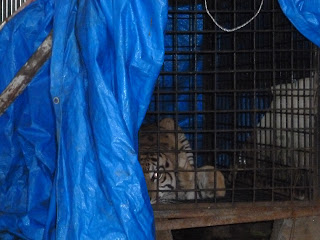
My friend Yanti from the elephant camp was also in Bengkulu, where she is officially based, to take care of a tiger that had been caught in a trap.   She invited me over to the Bureau of Natural Resources to see the creature.  When we went to the holding area outside the back of the building the tiger saw me and immediately unleashed a roar that made my hair stand on end.  My tiger expert friend in Sungai Penuh had described the roar of the Sumatran tiger to me in the past, but you really have to experience it to understand it.  From three meters away I was immediately as scared as I've ever been in my life.  Then the tiger focused its gaze on me and I saw death in her eyes.  I hope to God that I never run into one of these in the forest.  This particular tiger will never be returned to the wild, as Yanti had to remove eight of her toes.  She'll probably be sent to the Taman Safari zoo in Bogor on Java, where they have several dozen tigers that have been caught in traps. 

After meeting with a couple of NGO folks and a reporter for the national news service I headed out for Curup, which I'll describe in the next post.   

Thursday, June 28, 2012

The Journey South (Part 1)


This past week I have been travelling to parts south of my temporary home in Kerinci, Sumatra as part of my research about the "political ecology" of Kerinci Seblat National Park.  My goal is to visit a number of villages bordering directly on the park, meet with district planning officials and headmen, talk with folks from local non-governmental organizations and the press, and just generally see what's going on around the park.  So far my trip has taken me through parts of three provinces (Jambi, West Sumatra, and Bengkulu) and four districts (Kerinci, Pesisir Selatan, Mukomuko, and Bengkulu Utara).  Though it's possible to get around Sumatra on mini-buses, it's laborious inconvenient (especially when you try to get to remote villages), and uncomfortable, so I decided to make the long trip on my motorcycle.  Over the next 3-4 posts I'll describe some of the things I've seen and provide information about how to make your own motorcycle excursion around this part of the massive island. 

Longsor Alley


A landslide.  Guy in lower right for scale.

I set out on the first leg of my journey last Friday morning, aiming to reach the home of my friend Barlian in Sungai Ipuh, Mukomuko.  The first stretch of road takes you out of Kerinci Valley and over one arm of the Bukit Barisan mountains into Pesisir Selatan district in West Sumatra province.  This road through the hills is one of three access routes (the "Bukit Tapan" road) to Kerinci Valley, but it's the least used because of the condition of the road.  Though I've mentioned this in previous posts, when roads are cut through the mountains here the public works department generally doesn't approach the task in a way that will minimize ecological impacts and ensure that the road continues to function into the future.  In other words, mountain roads are crummy.  They have very steep cuts into the hills, and since it's very rainy here landslides (longsor) are a frequent occurrence.  When you cruise over the Bukit Tapan road, you can see the scars of at least a dozen landslides, which occur about once a year.  Smaller rock falls are quite common along this route.  This is a pretty tricky stretch of road because of the condition, but it passes through the park and you can see some nice vistas and good primary forest.  Along the way you'll pass trucks inching their way up the road; honk briefly to say hello.  Normally you can have a short conversation as you pass:

Driver: "Aiyoooooooooooooooooo...."

Me:  "He-eeeeeeeeeeyyyyyyyyyyyy..."

When you come out of the park you'll be in West Sumatra district; you don't have to see the sign to know because the road goes from gravel to beautiful blacktop.  Soon you'll enter Sako valley, a 15km finger of land bordered by the park following a beautiful river.  Sako valley is one of my favorite places on Sumatra.  It's quiet, cool, and the scenery reminds me of mountain streams in Colorado and Arkansas.  I always stop here at my friend Jon's restaurant to eat some dendeng batok (grilled strip steak) and get the latest news on the park.  A few miles down the road I generally stop in a coffee stall to play chess and drink tea with some local farmers, most of whom know me by now.  After a short drive through this idyllic setting you come to Tapan.

See if you can guess how many kids there are in the back of this truck.  Answer is in the notes below.


Road condition:


This leg of the journey is about 40 kilometers, but it takes two hours, including the 18 kilometer stretch from Jon's place to Tapan, where you can average 50-60 kph.  That ought to give you an idea of the condition of the road through the hills.  It's definitely worth the trip, but don't get in a big hurry through the mountains and avoid the road in heavy rain. 

The Guest of Honor....


Mobil internet truck in Mukomuko
The next stretch of my trip was from Tapan to Penarik, a small town about 35km south of Mukomuko city in Mukomuko district, Bengkulu Province.  Once you head south of Tapan the road is very nice, and you can cruise along the coast at a pretty good clip.  There's even a section along Keith's Beach (see below) where you can top out your bike if you're so inclined.  With a stop at another friend's coffee shop, this stretch takes around 3 hours.  At Penarik I turned off the main road to head for Sungai Ipuh, where my friend lives.  In Bengkulu there is one good road....the one that runs from Tapan to the south.  If you have to leave this road and head towards the interior, you should prepare your rear end ahead of time because it's a bumpy road.  The road from Penarik to Sungai Ipuh is about 15 kilometers, but it takes 30-45 minutes in good weather.

When I finally pulled in to Sungai Ipuh my friend Barlian and his family greeted me warmly,  After coffee Barlian said "You're in luck! There's a wedding ceremony tonight!  We can go if you like!"  Although I was looking forward to compiling my notes, this is the type of invitation you can't turn down.  The problem is, I hate Indonesian weddings because when a foreigner goes to a wedding he/she immediately becomes the center of attention, and that's uncomfortable for me.  Generally a wedding involves sitting around for 3-4 hours while everyone stares at you, and you have to answer the same basic questions several dozen times.  Village weddings are worse in this way because most villages rarely if ever have foreign visitors.  Village weddings are more interesting than town weddings, though, because entertainment at the latter generally consists of singing the same canon of karaoke songs at a volume that would rival the Krakatoa explosion.  Village weddings are also usually more traditional, whereas town weddings are all the same. 

Villagers don't understand why you wouldn't want to go to a wedding, because they are pretty much by definition community-oriented folks.  But to do fieldwork by yourself for long periods of time it helps to be something of a loner who doesn't mind, or even enjoys spending lots of time in isolation.  I am like this, and I guess one of the "weaknesses" of my personality is that I like to have absolute control over my timetable, because it enables me to get done what I need to get done and then relax in the way I like to relax.  Being at a wedding to me is a kind of work because of the type of interaction it entails.  I used to think about all the other stuff I could be doing rather than sitting around for hours on end, but I've learned to tell myself "relax bro.  You're going to get your work done.  Just relax".  So even if you don't want to be there, the important thing is to look like you are having a good time and appreciate the fact that you are the guest of honor.  There were dancers and a traditional band at this wedding (which went on and on), and some of the music was actually pretty good, like the song in the movie clip below, which I really liked.  The audio doesn't come out too well but this tune was pretty hypnotic.


Road Condition:


As I mentioned this road is really nice blacktop and there aren't any real hazards other than the traffic, which isn't too bad.  But the road in places is quite winding, and on one curve I slowed down to about 20 kph only to find waiting for me athwart the road a cobra snake, who came a snap-snap-snappin' at me like I was the eternal enemy of all serpentdom.  The son-of-a-bitch almost got me too. However other than that, the drive is enjoyable, passing through miles and miles of oil palm plantations with occasional views of the Indian Ocean.  There are some hills, but it is pretty smooth, and I was told by several people that the route is enjoyed by bicycle tourists from abroad.  There's a little warung along the way on the mauka side next to some oil palms that serves great mie rebus if you can find it, and you can also stop at one of the huts by an ocean inlet near the Mukomuko-Bengkulu Utara border to enjoy a coffee and the sea breeze.

Surf Mukomuko...


I mentioned this in a previous post as well, but due to coastal erosion thought by many to be caused by large-scale oil palm cultivation, Mukomuko has some great beaches.  There's one that you pass that stretches for several kilometers where the waves break smoothly and cleanly.  Every time I drive past this stretch I almost cry because the waves are perfect for surfing.  There are dozens of spots along this stretch, and so you could surf all day without anyone getting in your way.  It's all sand too, so there are spots that would be suitable for beginners.  The wind, at least when I've been there doesn't blow too hard and so it's pretty glassy, and it seems to come up best in the morning.  I've seen beautiful and consistent 7-foot faces at one spot, and the wave breaks to the right and left and just keeps going.  I've never seen anyone surfing there, but I think that's because it's out of the way.  I didn't bring a board with me since I live in the interior and I haven't had time to get one in Padang, so I haven't had the opportunity to paddle out and name the breaks, but I have taking the liberty to christen the whole stretch "Keith's Beach".  It's about a 20-minute ride south of Mukomuko city, which has a small airfield with 2-3 flights per week, so you could get there fairly easily.  If you want to drive down from Padang, it's probably around 6 hours.  So I hereby invite all the surfers of the world to come surf my beach.  You won't be disappointed.

On Monday morning my friend and I went up to Mukomuko city to see the district headman, but he was out of the office, and no one knew where he was or when he would get back (2).  We also visited the regional planning office, but there was no one there to answer our questions or provide us with the district spatial plan, so I left empty handed and disappointed.  But that's how it goes.  After spending a couple of days with my friend in Sungai Ipuh I got back on my bike and headed south to see another friend, who runs an elephant camp in Bengkulu Utara district.  I'll describe my time there in the next post. 

Notes


(1)  48

(2)  I suspect he was off doing a "studi banding" someplace. 

Sunday, February 12, 2012

A Journey Through The Minang Heartland...

This past week I took my little Honda on a 900-kilometer ride up north through Minangkabau country at the request of a friend of mine, who asked me to check out a cacao farm near Payakumbuh (I'll write about that experience in a future post).  The trip took me from Sungai Penuh in Kerinci Valley (where I live) up through Solok to Padang, over to Padang Pajang, through Bukit Tinggi, on to Payakumbuh and Lima Puluh Kota district.  On the way back I passed through Batusangkar and Ombilin, around Lake Singkarak and down through Solok city before returning through Solok and Solok Selatan districts.  It was definitely a trip to remember, and I'm going to use this post to share some pictures of some of the neat things I saw.

My first stop was in Padang, which I won't describe because I hate Padang (no offense).  But along the way you start to see indications of the rich culture of the people whose homeland you are entering.  One of the most noticeable aspects of Minangkabau culture is the style of architecture.  The roof of the traditional Minang house is the most distinctive feature; it is made to resemble the horns of a water buffalo, which is the symbol of the Minangkabau.  In fact the name Minangkabau means "triumphant buffalo.  You can see a couple of examples below.  The first is from Batusangkar.  


As you can see the houses are elaborately decorated.  This one is the home of an affluent family; there are also more basically decorated places.  Another characteristic is the finials or decorations at the top of the roof peaks.  Most of the time these are Islamic moon and crescents, but sometimes you see things like weathercocks or airplanes.  The next one is from a village outside Payakumbuh.


After I left Padang I headed for Bukit Tinggi.  The drive is really beautiful through the mountains and there is a stunning waterfall along the way.  Unfortunately, I broke a sprocket on my Honda in the hills.  Fortunately the town of Padang Pajang was only about 5km away, and so I was able to limp the rest of the way.  In most places there is a Honda service center, and the guys there replaced my chain assembly and changed the oil.  It cost about $40 and took two hours, giving me some time to wander around.  The picture below is of a lovely mosque there.


After my bike was fixed I moved on and spent a couple of days in Bukit Tinggi, which is a place I'd been before.  Bukit Tinggi is one of the centers of Minang culture and is well established on the tourists' path, so you can google it if you want to see pictures.  I really like it there; the weather is cool since it's at about 1000 meters and the food is delicious.  It's a great place to spend a couple of days.  In lieu of pictures I've included this video of a delightful street performer.  I was amazed at his ingenuity.  


After Bukit Tinggi I made my way over to Payakumbuh, about 45 minutes away.  This is a bustling little town with friendly people, and is a good base to explore the surrounding countryside.  In addition, all through Minang country (with the exception of Solok city and district), the roads are really good.  God bless the Minang and their road maintenance skills.  So you can get around fairly easily and quickly, but you still have to be careful because the people drive crazy.  

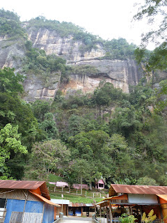
The next place I stopped was Harau Valley, about 15 km outside Payakumbuh.  The older I get, the rarer it is that I see something that is breathtaking, but the Harau valley definitely qualifies.  You can see a picture below, but this doesn't do it justice.  Harau valley is a narrow closed gorge with massive granite walls rising hundreds of feet on either side.  I'd never heard of the place before I went to Payakumbuh, but I would definitely recommend it to you.


While in Harau I has an experience that has helped to convince me that I need to get some basic medical training when I get back to the US.  I first had this notion seeing broken bodies from auto accidents being haphazardly moved, contrary to the basic first aid rules I learned in Boy Scouts.  On my way around the dirt track loop that rings the back of the canyon I picked up a local who looked as though he could use a ride.  He happened to be going to an out-of-the-way waterfall, where he was working as a laborer for some film students from Padang Panjang.  I hiked back to the waterfall and was chatting with some of the students and then it happened.  

One of the students started having a full-on grand-mal seizure.  When I was younger I used to have seizures, so I was familiar with the routine.  But then the seizure didn't stop, and the young man's breathing got lighter and lighter while his heartbeat became more and more regular.  I suggested lightly that the kid needed to be taken to a hospital or the local PUSKESMAS, but no one was listening.  After 15 minutes someone went to get "help" which arrived in the form of a local villager who quickly diagnosed "kesurupan", or "possession", which could be remedied with the proper prayers.  As time went on I could see the poor young man's life slipping away.  I didn't know what to do; I tried to call a doctor friend in the US but we were out of signal range.  I became more forceful, arguing that the problem was physiological rather than spiritual.  "What is it, then", they asked.  "I don't know.  I'm not a doctor, but it could be an allergy, a bite, epilepsy, too much sugar, too little sugar, many things.  But I know that we can't do anything....your friend needs medical attention.  So please for the love of God let's get him out of here.  PLEASE PLEASE PLEASE!"  Finally they relented and we carried the kid back to one of their trucks, but the local "healer" was not too pleased with me.  I felt so helpless, and I normally pride myself on being able to handle a crisis.  

The next two pictures are from Ombilan, which is a town on Lake Singkarak.  This is a pretty large lake, maybe 20 kilometers long, which is evidently a popular vacation place for the locals, but when I was there it was blanketed in haze, which I think comes from the burning of rice chaff.  The first picture shows a mountain pass.  In the second you can see a curious road sign.  It's pretty clear what it is advising drivers against; the question in my mind is why drivers need to be advised against this particular hazard.  


My next stop was more just to take a break from the road.  I paused to get some Sate Padang in Solok City, and while I was complaining to my new friend, the proprietor of the restaurant, about the miserable condition of the roads, a Minang wedding procession happened by on the side of the road.  One of the interesting aspects of Minangkabau culture is that it is matrailinial, and so property is inherited by the woman's side of the family.  Men leave their own extended families when they get married and become part of their new wives' families.  


One the folks I met on the road told me there are three types of Minang weddings:  for regular folks the ceremony and party lasts 3 days.  For people with "a little bit of money" it lasts 7 days.  For rich folks it lasts 40 days.  There are all sorts of neat courtship ceremonies as well, and if you ever get a chance to see any of them you should.  Below you can see another picture of the procession; all the ladies are carrying baskets filled with rice.


This next picture I think I'm going to send to Sesame Street.  I took this on the way back home.  There is actually a place called "Letter W"; it is right on the border of Kerinci and Solok Selatan districts on the Kerinci side, so it is in Jambi province.  It is basically a rest stop.  I asked the locals where the name comes from and they told me it's named for a nearby waterfall.  They didn't seem to know why it is called "Letter W" as opposed to "Huruf W".  They asked me if I would like to see the waterfall, and I asked if it was a normal waterfall or an extraordinary waterfall.  They told me it's pretty run-of-the-mill, and since I've seen dozens of waterfalls, I decided to take a raincheck.  They didn't seem to put out.  Incidentally, the distance to Sungai Penuh indicated on the sign is incorrect.  This is pretty common, so don't get your hopes up when driving.

In this last picture you can see yours truly.  I don't take a lot of pictures of myself, but I like this one.  This picture was taken when I stopped on the way home in Solok Selatan at a little shack to get out of the pouring rain.  In rural Sumatra the people are very welcoming, and they're usually happy to pass the time with you chatting and laughing.  The old man in the picture is a rice farmer; the younger fellow repairs motor scooters out of the shack.  I chatted with the old man about John F. Kennedy and President Sukarno, politics, and conservation.  We had a pretty good time as you can see from the picture.  It may sound corny, but encounters like this are my favorite part of the journey.  The kindness of normal Indonesian country folks is beyond remarkable.