Friday, December 30, 2011

Holiday In Bali #2: Rituals and Offerings

When you go to Bali one of the first things you'll notice is that there's always some sort of ritual taking place, from daily offerings at family compounds to village-wide ceremonies that involve dozens and sometimes hundreds of people.  The general name for temple festivals is odalan, but there are all sorts of periodic observations and rites of passage that are a major part of life (and the tourist trade) in Bali.  Everyday across the island offerings are made to the gods, the family's ancestors, and the two holy volcanoes, Agung and Batur.  These offerings are called Canang Sari and consist of fresh leaves, fruit, and other items placed on various altars around the compound.  These offerings have several purposes, but one of the main functions is to ensure the safety of the household.  In the picture below you can see a small altar with an offering that sits beside the pool at one of the places we stayed; this is to make sure no one drowns.  You even see offerings in automobiles to help with safety on the road.  You might also see palm fronds attached to some cars after the periodic ritual to bless all things made out of metal.  Some of the offerings are placed on the ground to appease demons.  Making and placing the offerings is one of the principle household tasks performed by women.  One Balinese person I talked to said that his mother usually makes around 40 of these a day, but on certain occasions she might make as many as 100.  This is pretty interesting, because if you think about it as an act of devotion, it requires the sacrifice of time that could be used to grow food, make money, or do anything else.

One of the rituals we watched is the Kecak dance, which is a dramatization of part of the epic Ramayana.  The 2-hour dance describes how Prince Rama's wife Siti is kidnapped by the evil goblin king, who spirits the aforementioned Siti away to his island while Prince Rama is off hunting.  In the very abbreviated version we witnessed Prince Rama's friend Hanuman, the white monkey god, rescue Siti with the help of his monkey army.  The ceremony was performed at night against the backdrop of one of the local temples, with a ceremonial fire burning in the middle of a circle of local men.  The men sang an intricate chant meant to symbolize a gamelan orchestra.  The percussive rhythm of the chant is actually pretty cool, and after a couple of beers (sold at the temple) I got pretty into it.  This particular troupe does this ritual a couple of times a week solely for tourists, whom they charge about $8 a head for the privilege of viewing this authentic bit of Balinese culture.

Next, on a trip to Batukau temple in Central Bali we happened on what was apparently the entire population of a remote village which had made the trip to this very sacred site as part of a ritual that takes place once every thirty years.  The participants told me that they made several stops along the way on this pilgrimage, and the ceremony at Batukau was the last step in the elaborate observance.  Since every village in Bali has to do this particular ceremony once every thirty years, I would imagine that you would have a pretty good chance to see the same thing.  It was interesting to see all the people decked out in special attire, but what was most interesting to me was how they arrived....standing in the back of cargo trucks.  They told me that they all parked their cars about ten miles away and board the trucks to cut down on traffic.  I've seen this type of "carpool" in many places in Indonesia (often times you see dozens of people packed shoulder to shoulder in the back of a dump truck), but I'm always taken aback by it.


We also had the chance to watch part of a cremation ceremony, called Pelebon.  This is one of the most elaborate rituals in Bali and takes a lot of preparation.  According to one person I talked to, because of the expense and effort involved, most villages save up dead people for about five years and then they do a collective ceremony for all of them together.  This makes sense when you look at the pictures; these elaborate floats were built for one ceremony, and it can't be reused because it all gets burned up in the ceremony.  The ritual is for renewal and purification so that the soul of the departed can come back and inhabit the body of a new family member, for as we learned in the previous post the Balinese view of the cosmos is cyclical in nature.    I heard several accounts of how the whole thing works, but evidently the big bull you see in the photo is the vehicle to convey the spirit of the deceased to the next world.  The guys carrying the bull float spin it around and tilt it back and forth to confuse the dead person's spirit so it doesn't come back to the village and cause trouble.  The big tower represents heaven and earth.  In preparation for this particular ceremony they actually took down the power lines, which cut the electricity to a significant part of town, so they could carry the big float to the graveyard without having to worry about getting electrocuted.  Below you can see a video of part of the ceremony.


Monday, December 26, 2011

Holiday in Bali #1: Temples and Subaks

If Western societies have spent the last thousand years laboriously disentangling the secular from the religious, the Balinese have spent the same period attempting to integrate them--  Stephen Lansing, The Three Worlds of Bali, 1983.

One of the most conspicuous aspects of the Balinese landscape is the ubiquitous temple.  If they seem to be everywhere it's because they are; in 1983 Stephen Lansing estimated there to be upwards of 20,000 temples on the TK square kilometer island.  The Hindu temples (pura) are one of the things that make Bali what it is.  They are also one of the main attractions responsible for the hoards of unwashed backpackers laden with Lonely Planets, pastel sets, and Bintang t-shirts that clog up the roads.  But as we'll see in this post, the function of Balinese temples are not limited to the spiritual realm; they are also an important pillar of civil society.  The temples also are aspects of a uniquely Balinese time-space geography.

Temples Temples Temples

A Balinese temple is best understood as a place where several cycles periodically coincide--cycles that connect the Upper, Middle, and Lower worlds.  Many of the most powerful forces at work in the Middle world originate outside it.  For life to continue in the Middle World, these forces must be accomodated--Lansing 1983:55.

Balinese Plintangan calendar from here.
Bali is an interesting island because it stands as a bastion of Hinduism in a sea of Islam.  Islam made its way to the archipelago in the 14th century and spread rapidly, replacing in many places the Buddhism and Hinduism that arrived more than a millennium previously (1).  Hinduism and Buddhism made strong marks in many parts of the archipelago and the legacy of these two world religions can be seen at places like Borobudor, Prambanan, and Muaro Jambi.  In Bali and parts of East Java, though, Hinduism remained strong and is the dominant religion today.  Like many of the Hindu kingdoms across Southeast Asia, society in Bali has traditionally been based on the Hindu ideal of the cosmos.  In this conception of the world, the realm of humans (the middle world) represents a sort of compromise between the world of gods (the upper world) and the world of devils (the lower world) (2).  In addition, in terms of time the universe operates in cycles rather than in a straight line from past to present to future.  Complicating this is the notion that everything in the Balinese cosmos has its own time cycle.  For example, there is a five-day week and a seven day week in common use in Bali, so when you combine these you get a "month" of 35 unique days (you can see a calendar in the picture to the right of this paragraph).  There are also longer-term cycles as well.  Ceremonies and rituals should take into account all of these various cycles, and so planning is something like finding the lowest common denominator for all the cycles involved.  The community temples represent the place in time and space when all of these cycles come together at a particular time.

Villages in Bali have three main types of temples:
  1. Pura Pusah--These are dedicated to Vishnu and are considered to be the "highest" temples.  They deal with the realm of water.
  2. Pura Desa--These are dedicated to Brahma and deal with the realm of fire.
  3. Pura Dalam--These are considered to be the "lowest" temples and deal with matters of "black and white", or cosmic balance. 
This structure of temples mirrors the political organization of the island and has roots in the old kingdoms of Bali.  Before the Dutch colonizers took over there were numerous small principalities across Bali, some controlling just a few square kilometers of paddy fields.  This fractious political reality wasn't really conducive to consolidated resource management or mobilization of labor.  However, apart from the patchwork of little kings there existed (and still exist) other structures of organization, complete with their own system of temples.

Subaks and Water Management

To get a perspective image of Balinese 'village' life one must take...a steroscopic view, looking at it on the one hand through the lens of the subak and on the other through that of the bandjar--Clifford Geertz, 1980:72.

One often-cited example of a temple network that transcended the petty principalities is the system of puras that regulates irrigation across Bali.  As you know by now, rice is the staple crop of most of Indonesia and Southeast Asia in general.  Rice is more than just food, though.  It's the foundation of society.  Think of it this way: in order to have a state or government, you need to be able to produce a surplus of rice, because you have to support people that don't work in the rice fields.  The production of agricultural surplus is probably the most important enabling factor in the rise of "civilization".  Wet rice is a good crop for producing surplus, because you can grow a lot of it in a relatively small area.  But in order to produce a surplus of rice, it's important to be able to control the flow of water, because wet rice is a fairly complex crop to grow.  Wet rice needs dry periods, but it also needs to be flooded for a good portion of the growing season.  So you have to be able to inundate and later drain the fields, and you can't always rely on the seasons for this.  Irrigation is really important but irrigation works take the cooperation and coordination of a lot of people to build and maintain.  So although it's hard to know for certain, here in Bali (and in many other places across Southeast Asia), people organized themselves to build irrigation works and terraces, and later complex government apparatuses grew out of this.

Diagram from Lansing, 1983; see references
In Bali the rice growing cycle is about 105 days.  That means you can get 3 crops of rice a year, which is a lot of rice (3).  However, since wet rice requires a lot of water it's better to stagger rice production so not every farmer is using water at the same time, and so you don't have too much rice at any one time.  This requires a high level of cooperation and coordination, and so farmers work together.  A group of farmers that draw water off the same canal is called a tempek (this refers to both the land and the association).  The members of the tempek elect a chairman, or klian.  They also cooperate on maintenance activities and rituals.  Usually it's the case that several of these canals feed off a common dam (empelan), and so all the tempeks that share a water source form a larger association called a Subak.  All people having land within the area of a particular subak are citizens of that subak (krama subak).  The subak is the primary unit of water management and is usually translated as "irrigation society", but it is more than just this; it is an agricultural planning unit, an autonomous legal corporation, and a religious community managing virtually every aspect of cultivation (Geertz, 1980).  The Subak generally has two temples: one near the dam and one near the rice fields.  The Subak coordinates planting and harvesting for all of the tempeks so that not everyone is planting or harvesting at the same time.  The Subak also manages all the rituals related to rice farming.  For some examples see the chart below.  Each year all the Subak chiefs in a given region meet at a mountain temple, or a pura masceti.  At these periodic gatherings the Subak leaders plan the ritual cycles for all the subak temples, as well as planting schedules and water allotments.  All of the pura mascetis fall under the authority of one of two lake temples, forming a coordinated system of water management that covers the entire island.  The two water temples are Pura Batu Kau in Tabanan, which has jurisdiction over western Bali, and Pura Ulun Danau, which is the master water temple for the north, south, and eastern portions of the island.

Table from Suradisastra, et al 2002; see references
The subaks have rules of management as well as a system of sanctions (sima) that keep the farmers in line.  This are codified in a compact or constitution called an awig-awig.  Subaks are very democratic and decision making is done by consensus at meetings (sangkepan) that take place every 35 days (according to the Balinese calendar).  They also coordinate collective work and religious ceremonies associated with cultivation.  Suradisastra et al (2002) describe the types of work committees (seke or seka) within the subak:
  • Seka numbeg: provides labor for land preparation
  • Seka tandur does rice transplanting
  • Seka mejukut does weeding
  • Seka merana does pest control
  • Seka manyi does harvesting
  • Seka gebros does rice selection
  • Seka sambang monitors water consumption.  
In the chart below you can see what sorts of rituals are involved in each of these tasks.
Table from Suradisastra, et al 2002; see references
A Subak Tour

Juwuk Manis Subak Map
There are subaks all over the place here, especially on the southern half of the island.  I spent a morning walking around one on the outskirts of Ubud taking pictures and talking to the farmers.  This particular subak is called Juwuk Manis, or "Sweet Orange" subak.  The subak has 97 members and consists of about 75 hectares.  The farmers I talked to told me that they only meet one or two times a year, which is consistent with the papers and books I've read (see references) about subaks.  Ubud is pretty urban, and so the social role of the subak association has weakened a little.  But in more rural areas (supposedly) the meetings are more frequent because the subak serves as a pillar of the community.  In addition I think, based on previous conversations around here, that much of the work is done by hired labor; in many cases the land owner isn't actually doing the planting, maintenance, and harvesting.  Nevertheless, it was neat to see an example of this institution I've read so much about.  Subaks are an excellent example of what geographers refer to as "community based natural resource management" or CBNRM.  We like to study CBNRM because these local systems might offer lessons or ideas for conservation in other places.  There are lots of examples of CBNRM in Indonesia; adat systems on Sumatra and other islands are instances of CBNRM.  In the future I'll write a more detailed post about adat principles and CBNRM around Kerinci Seblat National Park.  Below you can see some more pictures of Juwuk Manis subak.  In some of the pictures you can see slots in the canal wall; this is so the farmers can insert wooden slats to block one of the passages to control where the water flows.  Dig the farmer hauling off the 6-foot python I found in the last picture.  He wouldn't let me eat it, though....


Notes

(1)  This is something of a simplification.

(2)  In the Balinese conception of the cosmos, "devils" and "gods" aren't good or bad.  Rather they represent natural forces that are part of the larger cycle of existence.  According to this world view everything goes through a natural cycle of growth and decay.  The upper world represents the growth part of the cycle, whereas the lower realm represents the decay part of the cycle.

(3) Since Bali is very close to the equator, there isn't a lot of seasonal variation other than the monsoons.  This means that you can grow rice year-round.  

References and For Further Reading

Geertz, Clifford.  1980.  Organization of the Balinese Subak.  In Irrigation and Agricultural Development in Asia, Coward, E. Walter, ed.  Ithica, NY: Cornell University Press.  384pp.  

Lansing, J Stephen.  1983.  The Three Worlds of Bali.  NY:Praeger.  170pp.

Suradisastra, Kedi, Wahyuning Sejati, Yana Supriatna, and Deri Hidayat.  2002.  Institutional Description of the Balinese Subak.  Jurnal Litbang Pertanian, 21:1 pp11:19


Wednesday, December 14, 2011

When's My Pizza Gonna Come: Examples of Diffusion Processes in Kerinci Valley


Last night I went in to one of the half-dozen home-based dry goods shops within 100 meters of my temporary digs here in Sungai Penuh to pick up a couple of packs of indomie for dinner (even though, according to the doctor, I'm not supposed to eat indomie anymore).  The young man working in the shop was listening to Rancid, a band that's pretty popular amongst the "punk" set here.  I asked him if he'd ever heard The Clash, and a blank look came across his face.  I went back across the street, loaded some mp3s onto a flashdisk, and we transferred them onto his computer.  As we sat listening to the first few bars of London Calling, it dawned on me that this exchange, in addition to being an outstanding example of shameless copyright piracy, was an instance of the geographic process of diffusion at work.

The Spread of Ideas in Time and Space

Map from Peter Loud's Website
In the last post I introduced the idea of the space-time prism, a conceptual tool that allows us to visualize and map how people move through time and space.  Diffusion is another application of time-space geography, since everything that moves must be carried in some way (this includes goods, people, and ideas), and the rate at which some things move over space is influenced by other things that facilitate or slow down the process.  Sungai Penuh and the Kerinci Valley in general is an interesting place to watch diffusion processes because it's relatively isolated.  In fact, it wasn't until the early 20th century that the valley came under the control of the Dutch; in fact it was one of the last places in the archipelago to fall under the sway of the colonials.  Kerinci's isolation in the lap of the Bukit Barisan mountains long protected it from outside conquerors, which has given rise to its cultural uniqueness, but at the same time the valley's inaccessibility has slowed the spread of new ideas.  To get here you have to take one of three main routes through the mountains, which is daunting with an automobile.  In the days before cars and paved (or relatively paved) roads it was very difficult to get here, and so there is a significant distance decay between here and the "outside" world.  This simply means that the difficulty of traversing the mountains has a strong effect on the introduction of new stuff.  But new ideas do come to Kerinci.  We can use conceptual tools from the science of geography to understand how this happens.  Geographers think about the spread of ideas, customs, and goods in several different ways:

Expansion diffusion: this happens when an idea, practice, good, etc spreads across an area like a fire across a field.  In most cases the fire doesn't hop from place to place; it moves from areas that have already been burned.  Expansion diffusion happens when one person tells another; thus it an idea eventually makes its way through an entire area or population.  Hierarchical diffusion and contagious diffusion (below) are often described as subcategories of expansion diffusion.

Relocation diffusion:  Relocation diffusion happens when the people that employ the practice, idea, good, etc, themselves move or are moved to a new location.  Migration is the most common example of this; when people establish a new home in a new land they take ideas and customs with them, which often spread.  You can see my example of relocation diffusion in the picture to the left.  This is "Two Brothers Bakso".  These guys sell a tasty meatball and noodle dish that originates in central and east Java.  Though the brothers live in Sungai Penuh, they were born near Solo in central Java.  At a young age they moved with their parents to Sumatra as participants in one of the government's transmigration (transmigrasi) projects, which were designed to transfer people from very densely-populated Java to the "outer islands" of Indonesia.  The brothers' parents worked as farmers, but as you can see they've introduced a little bit of Java to Sumatra.

Contagious diffusion: When we hear the word "contagious", we usually think of diseases, which are spread from person to person via various vectors.  Contagious diffusion refers to the spread of an idea directly from person to person.  The best example of contagious diffusion here I can think of is the spread of Facebook.  When I first came here 5 years ago there were only two internet places in town, and they were both painfully slow.  However, something happened between 2007  and 2010 that lead to the mushrooming of internet "cafes" in Sungai Penuh and surrounding towns (1).  The proliferation of these establishments has made the internet available to a large segment of the population, and one of the first things people discover when the get online is Facebook.  It's become quite common for people, even small children, to ask me for my Facebook address when they see me around town.  Contagious diffusion is often likened to a wave of innovation passing through a region; in this case the internet and Facebook would definitely fit the bill.

Hierarchical diffusion: this happens when a certain segment of the population, usually leaders or the wealthy, adopt a certain practice and then it passes down through the hierarchy.  A commonly cited example of hierarchical diffusion is clothes fashions; new lines are introduced in centers like Paris and New York, and then they spread to other places via rich folks.  My example of hierarchical diffusion is the Toyota Land Cruiser seen in the picture to the right.  Land Cruisers are pretty expensive, especially compared to the average income in Indonesia, but they are also pretty practical in a place like Sungai Penuh, where is rains a lot and the "roads" often turn to mud.  At first only rich folks had these trucks, but now there is a small industry built around restoring beat up and broken down Land Cruisers.  Though these are still relatively rare, I've been told that more and more of them are appearing.  In addition there are a lot of less-expensive land-cruiser type vehicles cruising around.

Barriers

Map from here.
Diffusion processes are affected by external factors that encourage or inhibit the movement of ideas, customs, and goods.  Geographers refer to things that slow down diffusion as barriers.  There are several types of barriers.  Absorbing barriers are those that stop the spread of something in its tracks.  In the modern world there isn't much that completely stops the spread of ideas, but a few examples might be internet censors in certain totalitarian countries, or religious regimes that prevent women from driving.  Climate can also be an absorbing barrier.  For example, in low-lying areas of Sumatra malaria is relatively common.  However there is no malaria in Kerinci Valley because of the elevation.  The climate is cooler here which prevents the spread of the mosquito that carries malaria.

Other barriers are reflectors which alter the course of diffusion processes.  One of the classic examples of a reflection barrier is the city of Chicago and Lake Michigan.  Like all growing cities, over the past century and a half Chicago has expanded its borders.  However, since people can't live on water, the presence of the large lake has caused the city's expansion to move around the lake.  Have a look at the map and you'll get the idea.  In Kerinci valley Kerinci Seblat National Park functions as a reflecting barrier.  We can see this in the way that villages have expanded in certain parts of the valley.  Instead of opening up new land inside the park (2), village expansion has tended to follow the fringe of the park.


Some barriers act as filters, letting some things spread but slowing or completely stopping other things.  Political boundaries are a good example of this.  It's difficult to completely seal off a border; for instance you can't completely shut out communication transmitted through the air, but you can stop the flow of goods and people over land.  And even when borders are very permeable, sometimes other factors, like language, slow the process of diffusion.  There are also enabling factors, like technology.  One good example of this is cellular towers.  Handphones are pretty much useless if you can't get a signal, and you can't get a signal if you are too far from the tower.  The construction of cell towers in nearly every corner of the valley has enabled the rapid spread of handphones, and now nearly everyone has one.  You can see another example of an enabling technology in the picture to the right.  I've already mentioned the notion of "distance decay"; in the case of frozen or perishable goods this actually takes a literally meaning.  The advent of freezers in the minimarts of Sungai Penuh has allowed merchants to sell frozen goods, like "chicken" nuggets.  According to my tiger-chasing buddy, who has lived here for nearly 20 years, these ice boxes are really starting to change the diet here, for better or worse.

Thus we can see how the geography of an area is related to the rate at which new ideas are introduced.  For a long time the mountains functioned as a barrier protecting the people of Kerinci valley, but now the mountains have become an obstacle, limiting the rate at which new goods come to the people of Kerinci.  As we've seen in previous posts, this is also related to conservation, as the national park which surrounds the valley has become a barrier as well since its protected status prevents the construction of new roads, which would presumably increase the rate of diffusion because they would make it easier to access the valley.  For my part I'm eagerly awaiting the diffusion of Pizza Hut to the valley, as the one in Padang insists that my house is outside their delivery radius, and so they refuse to have a driver make the seven-hour trip to bring me a cheese-stuffed double pepperoni.

Notes

(1)  I'm referring to "warnets", which are shacks that have a bunch of computers hooked up to the internet.  Generally the connection is relatively fast, and you pay 20-40 cents an hour to use the internet.

(2)  As we know from previous posts, the existence of the park certainly hasn't stopped illegal encroachment and cultivation, but it definitely changes the predominant direction of expansion.

Monday, December 12, 2011

New Adventures in Malnutrition and the Poop on Thorsten Hagerstraand...


Photo from The Health Success Site


A time-space web model, in the sense of a flow of life-paths controlled by given capabilities and moving through a system of outside constraints, which together yield certain probability distributions of situations for individuals, should, in principle, be applicable to all aspects of biology, from plants to animals to men.  Torstein Hagerstraand, 1970.

The Problem...

Whenever I come to Indonesia I end up losing weight....a lot of weight.  Generally during the course of a three month stay I lose about 20 lbs, which, upon my return to Hawai'i, I quickly gain back.  Normally the weight loss is caused by a change in diet; I eat a lot of food from street vendors and places that would make your average health inspector descend into a cataleptic trance.  The food is good and somewhat nourishing, but frequently it comes with a post-meal bonus that is often euphemistically referred to as "Montezuma's Revenge".  This time however I've lost a bit more than that; so much that I had to cut a new hole in the belt I've been wearing for the past 10 years.  The "normal" symptoms, which I'm used to dealing with, turned into an debilitating 2-week long trial which sapped my energy and motivation to work.  I'm not a big fan of scatological humor, but to make a long story short, my intestines were leaking like the old Polish navy.

I described my symptoms to my tiger-chasing friend, who has lots of first-hand experience with various ailments.  "It sounds like you might have a mild case of amoebic dysentery", she told me.

"Dysentery?  That's AWESOME!  I was hoping I'd get dysentery or beri-beri or something like that."

"What's awesome about it?  Dysentery has killed thousands of people over the years", she cautioned.

"Yeah but do you know how much field cred you get for tropical diseases?  It's almost as cool as surviving a tiger attack.  I can brag about it to all the lab researchers when I get back home".

"Yeah but it could damage your liver pretty severely," she warned.

"Liver, schmiver.  I can get a new one of those.  David Crosby did it three times".

Nevertheless, she recommended that I seek medical treatment.  The next working day I made my way down to the "hospital" to talk to a doctor and check out the nurses.  As I sat in the consultation room discussing the intimate inner-workings of my intestines, I noticed a number of non-medical people peering in the windows and doors, including the parking attendant, a young man around 18 years of age.  I realized that soon everyone in Kerinci Valley was going to know about me and my "problem", and that I'd be subject to the potty-themed taunts of ojek drivers for the next 8 months unless I asserted myself.

"What are all these people doing here?" I asked the nurse.

"Oh, you're a foreigner, so they are curious about you."

"Don't my insides work the same as yours?" I asked somewhat rhetorically.  Then I turned to the guy peering in the window: "Scram, you little bastard.  This is between me and the nurses".

After a while the doctor arrived on the scene.  Dealing with all the "curious parties" put me in something of a persnickety mood, and so my carefully concealed wiseass American nature emerged from within.  The doctor examined me and then gave me some nutritional advice.

"Usually problems like this are caused by diet".

"That's a real revelation, Doc".

"You need to eat three meals a day..."

"What a novel concept..."

"And avoid Indomie (instant noodles)..."

"Well what am I going to eat then, Doc?"

"I suggest rice..."

"Where am I going to find rice around here?"

I left the hospital with four types of medication: Tyran (ranitidine), Diadium (loperanide), Lapikot (trimethoprim and sufamethoxazole), and Scopamin Plus (hyoscine-n-butylbromide and paracetamol).  I'm happy to report that after a week my innerds are functioning like clockwork, and I've got a lot more energy.  I don't know if I had amoebic dysentery or not since I didn't get any labwork done, but I did get to ruminating on the applications of geographic theory to the squirts.

A Pioneer in Time-Space Geography....

It was primitive economics to assume that banks should worry about the identity of coins.  Is it advanced or primitive social science to disregard the identity of people over time in the same fashion?  This is what we do in most cases when we treat a population as a mass of particles almost freely interchangeable and divisible-- Thorsten Hagerstraand, 1970.

The more I thought about my gastrointestinal challenges, the more I realized that it is an quintessentially geographic problem, because my debilitated condition created not only a spatial constraint, but a temporal one as well.  Most people realize that geographers are interested in how things are arranged on the landscape, but we are also interested in the temporal dimension as well.  I thought back to the work of the legendary Thorstein Hagerstraand, a brilliant Norwegian geographer who is regarded as one of the pioneers of incorporating time into geographic theory and analysis.  Hagerstraand's body of work is expansive, but in his 1970 presidential address to the European Congress of the Regional Science Association, he unveiled the seminal concept of time-space prisms.

The time-space prism deals with the range of possible activities that can be achieved by an individual in a given timeframe.  In 1970 Hagerstraand was concerned that people were being treated like objects in planning processes.  He reasoned that for people, in addition to spatial coordinates, a given location also has time coordinates.  He distinguished this from previous studies of locational analysis because the movement of materials is most important when considering inanimate goods.  In the diagram to the right you can see the basic concept.  In the y direction you have time, whereas in the x dimension you have space.  It helps to visualize the model in three dimensions, with the diamond representing a prism (hence the name).  Hagerstraand assumes that most people have to return to a home base at the end of the day; home base is a place to store goods and to sleep.  As you can see the prisms get bigger if you change the mode of transport, because bikes, cars, and planes enable us to cover greater distances in the same amount of time.

Within the prism we encounter obstacles or limitations.  Hagerstraand identified 3 types of constraints:

  1. Capability constraints:  "Those which limit the activities of the individual because of his biological construction and/or the tools he can command" (12).  Sleeping and eating are examples that affect all of us.  
  2. Coupling constraints: These are obligations or other requirements that limit our freedom in traversing the prism.  Going to work, going to school, appointments, and other set-time events are coupling constraints, because you have to be as a certain place at a certain time.  Hagerstraad refers to groupings of several individual paths as "bundles".  You can think of these as organized activities.  For example, the functioning of a factory depends on a lot of people being in specific places doing specific things.  
  3. Authority constraints:  Hagerstraand uses the terms "domain" and "control areas" to refer to places that have limited access.  For example, you can only go to the bank during certain hours; outside of those hours the space of the bank would be an inaccessible gray area on your time-space prism (unless, of course, you are a burglar).  

Each of these three constraints comes together in our own personal time-space prisms.  Below you can see a diagram I took from Hagerstraand's original article; it isn't as descriptive as it could be but you can probably get the idea.  The whole point of the article, though, is that planners need to take these constraints, as well as individual capabilities, into consideration when building public spaces or deciding how cities should be laid out.  As we'll see in a moment, this framework of analysis is quite useful for understanding dysentery and other nasty ailments.


The Geography of Montezuma's Revenge...

I borrowed Hagerstraand's idea to illustrate how dysentary, which would be considered a "capability constraint", altered the achievable landscape in Sungai Penuh.  The first illustration of this is the simple time-space prism to the left.  As you can see, not much time elapses before a visit to "home base" is required.  The next step was to apply these to the real landscape.  The results can be seen on the map below.  The four letters denote the four accessible places in town I know to have western-style toilets.  After more than a decade in and out of Asia I still haven't mastered the art of the squat toilet, and given the sensitive circumstances of my condition I didn't want to take any chances (you can think of this as a "coupling constraint").  So the four locations can be thought of as temporary home bases.  The buffered areas around the locations represent the estimated distance that can be covered on foot between "episodes" and should be imagined in three-dimensional space.  Here we find our last type of constraint, the "authority constraint", because there are laws that prevent one from evacuating one's bowels on the sidewalk.  The map reveals that dysentery has a significant effect on one's daily activity space.  For example, it would not be possible for me to walk to the national park HQ, where I do a lot of work.  The main market is also at the very fringe of achievable activity space, and so the more time you spend bartering and haggling, the more your space contracts.  In addition the map shows us that to get anything done, one must plan carefully, sequencing activities in several stages.


So once again we see how geography can enlighten our lives and help us make sense of the chaos around us.  The main lesson here is watch what you eat, and bring your own toilet.

References and For Further Reading


Hagerstraand, Torsten.  1970.  What About People In Regional Science?  Ninth European Congress of the Regional Science Association.  

This article is really worth reading, but you won't be able to access it unless your library has a subscription to one of Wiley's overpriced digital repositories (or unless your library has the actual print version).  UH has back issues of this particular journal, but not in the electronic format.  Since I'm in Indonesia, it's not very convenient for me to go over to Sinclair library.  I tried to find it on line, but it turns out that Wiley is holding the article hostage, and you can only look at it if you pay 35 euros.  Fortunately, however, the gods of scholarship smiled upon me and the article somehow emerged out of the ether.  If you want to read the article and can't find it, it might emerge out of the ether for you too, if you were creative enough to track down and email someone that might be willing to help you in your quest.  

Saturday, December 10, 2011

Harnessing the Water in Tanah Air: Mikrohidro in Indonesia

Photo from Yayasan Mandiri
Kami sampaikan bahwa listrik yang kini menerangi rumah mereka itu sangat bergantung pada air.  Sedangkan air sangat bergantung pada hutan.  Jika masyarakat senang dengan adanya listrik dan ingin terus menyala, mereka harus menyayangi hutan.  Suriani, head of the Kelompok Simpan Pinjam Meratus Indah cooperative, quoted in Kompas 12/8/11

Today's post is inspired by an article that appeared in Kompas (1) about a mikrohidro (micro-hydropower) project in South Kalimantan province.  Mikrohidro refers to hydroelectric installations that produce up to 100kw of electricity (wikipedia).  Mikrohidro projects by nature are small and usually provide enough electricity to a number of households or a village to power small appliances, like lamps or TVs.  They typically employ any of a number of different types of turbines on small streams.  Indonesia (and Southeast Asia in general) is an ideal place for mikrohidro given it's location smack in the middle of the InterTropical Convergence Zone (ITCZ).  Rainfall averages about 2100mm/year across the archipelago, with 4,257 cubic kilometers of rain annually (runoff of about 2,128 cubic km).  In addition, about half the total land area of the country is mountainous, which creates the vertical gradients necessary for harnessing the kinetic energy of falling water.  60% of the population of Indonesia is rural, which makes it expensive and technically challenging to link up remote villages to the national grid, so the potential for small-scale hydropower is indeed intriguing.

Graphic from microhydropower.net
I've long been fascinated by micro-hydroelectric projects because of the potential benefits, but also because they are pretty cool.  The first time I saw a microhydro generator was about 10 years ago in the hills or northern Vietnam.  That particular gadget was pretty small and provided only enough electricity for a couple of light bulbs, but I was really struck by the ingenuity.  At the time only one house in the village was enjoying the benefits of electricity (I presumed the turbine was privately owned), but it was easy to imagine the benefits of more turbines.  Here in Indonesia I've seen several mikrohidros in villages around the national park.  They are larger scale; one we visited near Gunung Tujuh provides about 3000 watts total to around 10 households.  The members of the "cooperative" pay 15,000 (US$1.75) rupiah per month for their electricity.  The turbine is run by a small waterwheel turned by water flowing though a small canal which runs off a main stream that brings water to rice fields.  When a sluice gate is opened the water turns the turbine, providing electricity.  The sluice gate is helpful because the villagers don't need electricity all the time, so limiting the use of the turbine saves on wear and tear.

The Kompas article describes how a remote village had adopted mikrohidro.  This particular project generates about 8,000 watts, which is shared among 42 households at 200 watts/house.  They use the electricity from 5pm until 7am unless there is some sort of special activity.  The members of the community have regulations on what they can use the electricity for; lights and televisions are okay, but ice boxes and washing machines are prohibited.  The idea, according to the head of the cooperative, is to conserve the electricity while discouraging "consumerism" in the village.  Each household pays 40,000 (US$4.70) rupiah per month which pays for upkeep and maintenance.  To be eligible to receive electricity the members have to sign a written agreement that they will help take care of the water catchment area.
Drawing from here.  
 In this particular system this means that no trees within 200 meters of the riverbank can be cut down.  If someone disobeys the covenant and cuts down a tree, they have to plant 5 replacement trees.  If someone opens up a field for cultivation in the protected area, they have to pay a fine and they also lose their access to electricity.

The trees are protected because they help ensure a stable water supply, without which the turbine wouldn't work.  Trees are an important part of the hydrological cycle because when it rains trees keep the water from entering the stream all at once.  In addition to slowing the water down with their leaves, trees absorb thousands of gallons of water into their roots.  Water is carried up through the tree and is evaporated directly out of the tree's leaves (transpiration), and is released back into the air.  Eventually this makes it rain.  If you cut down all the trees, not only does the water flow more quickly into the stream, you lose the storage capacity of the forest as well as the rain-generating aspects, and so you undermine your steady and dependable supply of water.

Benefits and Potential of Mikrohidro...

Water is an abundant resource in Indonesia.  The UNDP estimates that the country has hydropower potential as high as 62.2 gigawatts, including 458 megawatts of mikrohidro.  Thus far, though, only around 5 megawatts have been installed in rural areas, and it's estimated that only about 1 megawatt of this is being used.  At the same time, about 40% of Indonesian households lack electricity, and over the next two decades electricity consumption is expected to grow by 450%.  Though the state-owned electricity monopoly (PLN) has greatly increased its capacity (growing from less than 800 megawatts in the mid-1970s to around 21 gigawatts by the end of 2002), it has difficulties expanding the national grid for a number of reasons.  A big limitation is the cost of the infrastructure required to deliver electricity from a large power plant to rural villages.  Another problem is the company's finances; they are deeply in debt, which was exacerbated by the 1997 financial crisis.  During the crisis the value of the rupiah declined sharply versus the dollar, which had the effect of greatly increasing the value of PLN's debt.  At the same time PLN has to buy fuel and spare parts on the world market, and so a weaker rupiah makes these things more expensive.

Renewable energy potential in Indonesia
This opens up an opportunity to develop alternative power generation like mikrohidro.  Mikrohidro has a lot of advantages.  Hydropower is said to be one of the most efficient sources of electricity, with effeciency rates as high as 60-90% (2).  Mikrohidro is highly predictable and there isn't much variability in supply from day to day.  Experts say that the equipment can be engineered to last half a century.  It is renewable as long as the water catchment area is maintained, and it doesn't release greenhouse gases into the atmosphere.  In addition, by locating the generating capacity near the demand for electricity, you don't have to build or maintain the expensive infrastructure required with national and regional grids.  Think of how much it costs to build high-tension transmission towers.  Mikrohidro eliminates inefficiencies in the electrical grid, as local subscribers have to abide by usage rules.  More electricity also has indirect effects; light enables children to study longer, thereby improving education. Electricity for cooking reduces the amount of time spent looking for firewood, a job usually done by women, which gives them time for other activities.  Decreasing the use of wood, kerosine, and other fuels in cooking also cuts down on smoke inside the house, which has significant health benefits.  Excess electricity can potentially be sold to the national grid or to other users, creating a new revenue stream for the village.

Mikrohidro also avoids many of the adverse environmental impacts of larger hydropower projects.  Big dams lead to the inundation of large areas, which takes land out of production and often leads to the relocation of people (3).  In addition big dams can hamper or all together stop fish migrations on rivers.  Dams alter streamflow characteristics like velocity and volume, and thus have sometimes deleterious downstream effects.  Many dams also eventually become useless due to the accumulation of sediment behind the dam; when a stream enters a reservoir the water current slows down, and so it loses its capacity for sediment transport.  The sediment settles to the bottom of the reservoir, making it shallower and shallower over time.  Mikrohidro projects use the existing water flow to generate power, so no dam has to be built.

But starting a mikrohidro project is not as easy as it seems.  The gear is expensive, ranging from US$1,000 to $700,000, depending on generating capacity.  Access to this kind of money is often beyond the reach of villagers, and so foundations, non-governmental organizations, and multi-lateral lenders provide funds, but demand is far greater than supply in terms of donors.  In addition, Indonesia is still working to create a conducive business environment for mikrohidro.  Though the government passed a law in 1995 to allow small power producers to sell electricity to PLN, it took a long time for the law to be implemented.  New regulations were created in 2002 to make it feasible for independent producers to sell power to the grid.  This makes mikrohidro attractive to investors.  And the more investment you have, the greater the demand for equipment, which can spawn a domestic industry catering especially to the mikrohidro market.  Still, a UNDP study indicates that even when mikrohidro projects go online in Indonesia, they frequently perform under capacity or don't function at all.  It's estimated that one-third of all mikrohidro projects fall into this category.  There are many factors contributing to this problem: in many cases local people lack the capacity to operate and maintain the equipment.  In other cases spare parts are too expensive or just aren't available.  That's where IBEKA comes in.  

A Mikrohidro Crusader...

Map from IBEKA
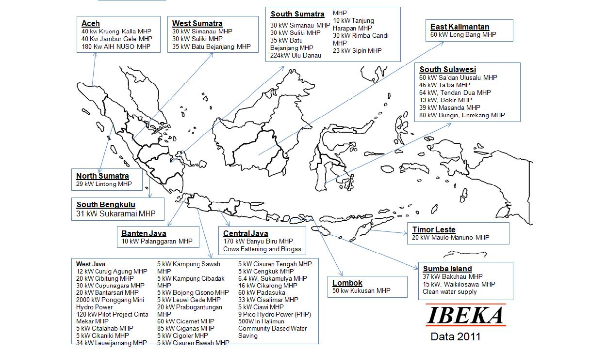
One non-government organization (NGO) is working hard to bring mikrohidro to villages across Indonesia.  IBEKA (Institut Bisnis dan Ekonomi Kerakyatan, People-Centered Business and Economic Institute) was established in 1993 and has built more than 60 community-run hydropower plants with between 5 and 250 kilowatts of capacity, providing electricity to 500,000 people in rural Indonesia.  At the heart of IBEKA is Tri Mumpuni, IBEKA's executive director, and her husband, Iskandar Budisaroso Kuntoadji, who oversees technical aspects of mikrohidro projects.  For her efforts "Bu Puni" has been recognized by President Obama, and just this year she was awarded the Ramon Magsaysay prize, a prestigious award for pioneers in community development in Southeast Asia.  Bu Puni's goal is to bring electricity to the 90 million Indonesians without it, but for her it's not just about power.  It's also about empowerment; IBEKA's projects seek to bring technical know-how to villages as well building capacity to manage their projects, which, it is hoped, will spill over into other community-building activities as well.  Community ownership is central to IBEKA's work; this is seen as the key ingredient in creating a self-sustaining project.

Mikrohidro, and community development projects in general, are about empowerment.  IBEKA has learned the valuable lesson that community participation is an essential ingredient in fostering a sense of local ownership.  Mikrohidro projects help people make the connection between sustainable livelihoods and environmental well-being.  Since people more immediately feel the effects of environmentally destructive practices, like cutting down trees in water catchment areas, they tend to think twice, and in many cases they create systems to regulate the resource and sanction people that break the rules.  These are lessons that we should all learn.

NOTES

(1)  Kompas 12/8/11: Menjaga Alam Dengan Mikrohidro.  Unfortunately Kompas doesn't allow you to read certain articles online without paying a premium.

(2)  I got these numbers from a micro-hydro guidebook; I'm a bit dubious about the 90% figure.  The point, however, is that hydroelectric power is much more efficient than systems that rely on fossil fuel.

(3)  There is a rich literature on the human costs of large hydropower projects; during its 6 decades of work the World Bank has often been criticized for supporting these types of projects because of the impacts they often have on local communities.

REFERENCES AND FOR FURTHER READING

Christian Science Monitor Story on Tri Mumpuni, coincidentally written by a young lady that once screwed me out of a story when I was writing for the Asia Times, can be found here.

IBEKA's website (mostly "under construction") can be found here.


Friday, December 2, 2011

The Human Costs of Corruption: The Collapse of the Kartanegara Bridge


Photo from here

Even today the government seems incapable of providing an infrastructure to support the population, too distracted as it is with maintaining an outmoded feudalism whose intention is to protect dynastic wealth and privilege at the expense of social progress.  Yohannes Sulaiman and Philip Turnbull, Jakarta Globe 12/1/11

Saya kira ini akhir hidup saya.  Yaya, a victim of the Kartanegara bridge collapse, Kompas 11/28/11

At approximately 4.15 pm on Saturday, November 26 a primary cable supporting the Kartanegara suspension bridge in Tenggarong, East Kalimantan snapped (1).  As a result of this catastrophic material failure the bridge collapsed, dumping the road along with all its traffic into the Mahakam River 40 meters below.  By Tuesday, November 29 the death toll had reached 18 and another 22 people were still missing.  The search for bodies has been hindered by the depth of the river and the speed of the current.

Picture from here
Construction of the 710 meter Kartanegara bridge began in 1995 and was competed in 2001 at a cost of 150 billion rupiah (US$17.7 million).  It was modeled after the Golden Gate Bridge and was celebrated as a technological advance when it was opened.  The bridge was designed to last for at least 25 years, and so its premature collapse last Saturday has raised questions about corruption, incompetence, and negligence in the construction industry as well as government agencies responsible for oversight and maintenance of public infrastructure.  However, instead of addressing the questions, the companies involved in the construction and maintenance of the bridge, as well as officials in both the Tenggarong district and national public works agencies, have been quick to point the finger of blame at one another.  Understandably they are none too eager to assume any responsibility for this tremendous cockup that has shaken the public's trust in the construction industry and the so-called public servants tasked with the responsibility of overseeing them.  The national police have already sent investigators to the scene, and the deputy chairman of the Corruption Eradication Commission (KPK) (2) has openly stated that "dishonesty" in procurement and construction led to the collapse.


Rampant Corruption

Photo from USA Today
The collapse of the Kartanegara bridge is a visible symbol of many of the problems associated with construction projects in Indonesia.  While it is too early to draw certain conclusions, there are suggestions that materials used in the bridge's construction were substandard.  In addition it has been reported that an independent inspection of the bridge in 2006 revealed structural problems, including the fact that one of the support pillars had sunk 50 centimeters in 5 years.  Moreover it was found that some of the anchor blocks for another of the bridge's pillars had shifted by 18 inches.  The firm responsible for the inspection recommended 23 billion rupiah (US$2.7 million) in repairs, but only 1.6 billion rupiah (US$118,235) were budgeted.  Between 2008 and 2010 no money was budgeted for repair and maintenance of structure.  Experts say that the key to the safety of suspension bridges is regular maintenance, but in this case as well as many others across the country, the government has failed to provide adequate resources for infrastructural upkeep. 


The company that built the bridge, Hutama Karya, insists that it is only responsible for problems that arise within the first half year of the bridge's opening.  When told about the shifting pillars and blocks, the director of this LARGE ENGINEERING COMPANY responsible for MULTI-MILLION DOLLAR PROJECTS said he wasn't aware of the movement.  He further stated that "as far as we know, it doesn't matter if it's shifting.  As long as the bridge is still working, then it's fine....Besides, no one ever complained about the shifting".  In other words, the construction company guarantees its work for no more than six months and maintains that significant shifts in structures like bridges are nothing to worry about.

Graphic from Indonesia Media
In a country perpetually ranked among the most corrupt in the world the construction industry stands out as one of the most egregious offenders.  Indonesians refer to public service positions dealing with development projects as "wet places" (tempat basah), meaning that there are ample opportunities for graft (places where the bribes aren't as lucrative are "dry places", or tempat kering).  Part of this stems from the amount of money spent on infrastructure projects (for example, Indonesia's 2011-2025 development plan calls for nearly half-a-trillion dollars in investment), but it is also due to the close relationship between developers and politicians.  Project budgets are generally inflated as politicians receive kickbacks for awarding contracts to favored companies, often run by cronies or even family members.  Procurement of materials and equipment provide opportunities for bribery, and lack of oversight enables construction companies to skimp on materials.  For example, a favorite tactic in road construction is to increase the amount of filler (like sand) used in concrete and asphalt mixtures.  This lowers the cost so the contractor can pocket the difference, but it also drastically decreases the quality of the road.  Anyone that has traveled in Indonesia is familiar with the results; roads pockmarked with holes that are in some cases impassible in the rainy season.

Maintenance of roads, bridges, and infrastructure are neglected because upkeep doesn't offer the same opportunities for graft as does construction.  In addition, politicians love new infrastructure.  Campaigns are built around promises of new facilities, and politicians point to the number of new roads and bridges built under their watch as proof of their performance.  Infrastructure is a visible symbol of "economic development", and this connection is backed up to a large degree by orthodox economic thinking, which holds that countries need to invest in infrastructure to develop.  Thus roads are not only good politics, but they make economic sense as well.

What Does This Have to Do With Geography?

Roads are the backbone of transportation and distribution networks, which are a key interest of geographers.  In addition, economic geographers are concerned with the level of infrastructure in a given country as this provides clues as to economic potential.  In contrast to economists, though, geographers are more concerned with the processes behind infrastructure development (selection of locations, routes, and specific projects) as well as the effects of new development (anything ranging from how the project changes patterns of movement and flows of goods to conflicts arising from the construction project).  Roads are inherently political in that they tend to be advocated by certain groups for certain ends.  The choice of location often involves prioritizing one group or interest over others, and by studying these processes geographers can understand informal structures of power as well as "politics of identification".    

Despite large "investments" in infrastructure, Indonesia's freight-transport network is ranked among Asia's worst. (Jakarta Globe 12/1).  This makes international and domestic shipping more expensive, which raises the costs of everything from raw materials to finished consumer goods.  This obviously affect the economic progress of the nation.  The question is, how can this problem be addressed.  Corruption in construction is part of doing business here, and it can be seen at every level of government.  For example, in an impressive study of 608 village road projects "missing expenditures" were found to account for an average of 24% of project costs.  "Missing expenditures" refers to money skimmed from wages, materials, and other accounting irregularities.  One of the more interesting findings of the study was that the guarantee of a government audit (3) only reduced the average "missing expenditures" by 8 percentage points, which suggests that the government's auditing agency is not very effective in detecting corruption.  Thus it seems the whole system is broken, from the tendering process to implementation on through to monitoring and auditing.

Never Forget....

It's uncertain what the impact of the catastrophe will be.  Plans are already being drawn to construct a new bridge at a cost of US$33 million.  Cynical Indonesian commenters are convinced  that it will be business as usual, but as an outside observer I hope that the terrible loss of life causes Indonesia's political leadership to re-examine the way infrastructure is developed here (4).  There's more than enough blame to go around as this episode represents a complete failure of governance.  The victims of the tragedy and their families deserve a complete inquiry into the case, but no amount of investigation or reform will compensate them for their loss.  Hopefully they will not be forgotten.  The bupati of Kutai Kartanegara, for her part, has proposed a unique way of remembering the victims: she says that debris from the bridge will be left as a memorial to the tragedy that occurred there.  Evidently the cleanup industry isn't as "wet" as the construction industry.


Notes

(1)  More recent reports suggest that it was the failure of a clamp, rather than a cable, that led to the collapse of the structure.  

(2)  The KPK is not able to investigate the construction of the bridge because it predates the agency's mandate.

(3)  The goal of the study was to gauge the effectiveness of several methods of reducing corruption.  In a number of the cases project organizers were told with certainty that an audit would be conducted on completion of the project.  According to the author of the study, the baseline audit rate is about 4% of all projects, so this assurance raised the certainty to 100%.  Audits were in fact carried out in each of these cases, but the study revealed that even when there were missing expenditures, the auditors had a hard time finding conclusive evidence that would enable them to prosecute the culprits.  The study is available online and can be found in the references below.  

(4)  To see some of these comments click on the story links below and read the reader comments.  They are quite revealing.  

References and For Further Reading


Olken, Benjamin A.  2007.  Monitoring Corruption: Evidence from a Field Experiment in Indonesia  Journal of Political Economy 115:2, pp200-249.  


Sunday, November 20, 2011

A Geographic Solution to Kerinci's Agricultural Woes: The Distance to Market Problem

Picture of Von Thunen from Wikipedia
As I've mentioned in previous post, the Kerinci Valley is one of Indonesia's prime agricultural regions.  Because of its situation, it's also quite far from large market/export centers.  The port of Padang is about 7 hours to the north, and Jambi city is 12 hours through the mountains.  Thus Kerinci farmers face a significant obstacle to getting their goods to market.  In this post I'll review one key geographic model about the relationship between market distance and crop choices and then propose a novel solution to the distance to market dilemma faced by Kerinci's farmers.

Von Thűnen's Rings

Geographers have long been interested in the relationship between distance to market and agricultural production.  One of the earliest and best known models was developed by Johann Heinrich von Thűnen, a German land owner and geographer active in the early 19th century.  Von Thűnenwas interested in why farmers decide to grow certain crops in certain places.  His model, known vernacularly as "Von Thűnen's Rings", was published in his "Isolated State" in 1826.  Von Thunen argued that there are three key variables that affect crop choices: land rent (or production costs), market price, and transport costs.  Von Thűnen's Isolated State has several conditions:

  • There is a centrally located market town...
  • The land is an isotropic plane, meaning there is no topographical variation
  • Farmers are rational decision makers
  • Farmers are able to transport goods directly to the market. 

According to Von Thűnen's calculations, there is a pretty significant distance decay for agricultural products.  This causes the emergence of several discrete zones of production radiating out from the central market town.  Since farmers on the isotropic plane don't need to worry about roads, these zones take the form of concentric rings, as shown in the diagram.  Von Thunen's model is pretty simple and basic (and contrived), but it is instructive.  Let's take a look at an example.  Below I have some hypothetical production and market data.  We can use this to figure out how profitable each crop will be in various locations, which is all the "rational" farmer needs to know to make his/her decision. 


                                     Milk      Forest   Extensive Field Crops   Ranching      
Market Price                 180         140                      105                     60      
Cost of Production         60           45                        32                      20      
Transport Cost/km         25           15                         8                         4   

Based on this data we can make some simple calculations.  Milk goes bad fast and it has to be refrigerated or brought to market quickly, which contributes to its costs of production.  Ranching, on the other hand, costs much less because the cows, lambs, goats, etc that you raise can transport themselves to market by walking.  Let's calculate the productivity per distance.  Below you can see the simple spreadsheet I made for profitability.  At each distance I highlighted the most profitable crop in green.  As you can see, Up to somewhere between 2-3 km, milk is the most profitable, so that's what farmers will produce.  But as you move farther away from the market the crop choice changed, until finally farmers choose ranching!


Like I mentioned, this is a very basic model, and like all models it doesn't exactly demonstrate reality.  But geographers through the years have demonstrated several examples that loosely correspond to Von Thűnen's rings.  To the left you can see one famous example from Uruguay.  But it's important to remember that Von Thűnen's model is on an isotropic plane and so topography doesn't matter and all goods are transported in the same way.  The real world doesn't work like that, though.  In the real world there are natural obstacles, like mountains, as well as transportation options that lower the cost of moving goods to market (think of trains and rivers).  So we can modify the Von Thűnen model by adding a river.  Look at the diagram below (from the Human Geography I use when I teach introductory geography).  As you can see, the river changes the picture significantly.


When we start to make the model more realistic, it becomes much more useful.  Have a look at the graphic I lifted from Hofstra (who lifted it from a couple of well-known geographers).  On the left you see the very basic model applied to the US in the 19th century.  It's not very accurate.  However the second model adds climate factors, which are really important in agricultural decision making.  With the addition of this consideration, the model corresponds much more closely to actual conditions.


AMBROSIA!!!

So as we've seen, one strategy for dealing with distance to market is to change crop choices.  There is another strategy, though: add value.  Many agricultural commodities are time-sensitive; that is,  they will go bad if they aren't consumed quickly enough.  This was a big problem in the frontier grain producing areas of the US in the 18th and 19th century, before the increase in western urban areas and the advent of railway and refrigeration technology.  So farmers figured out that in order to make a living, they needed to add value to the grain they produced.  The solution was simple: distillation.  Farmers on the frontier, far from markets, started making whiskey from grain since whiskey keeps for a long time.  It's also much more valuable per unit volume, and so the transport costs decrease for whiskey.
Cartoon from here.

These pioneering whiskeymen might have been forgotten to the world if it weren't for a tax levied on corn in the form of hooch levied by the fledgling US government in the 1790s.  The Pennsylvania distillers refused to pay the tax and even took up arms against the federal government.  Then president George Washington raised an army and marched to Western Pennsylvania, but by the time he arrived the rebels had already dispersed.  The "Whiskey Rebellion" ended up without a shot being fired, but it did demonstrate the willingness of the new nation's government to enforce its laws.  It also provided an outstanding example for generations of geographers to use when discussing distance to markets.   

Kerinci's Potatoes...
Picture from here
But what does all this have to do with the Kerinci valley (1)?  Well, Kerinci is well-known for its potatoes (for a number of reasons).  The climate here is just about perfect for raising the tubers, as the temperature is cool enough (68 degrees) for "tuberization" to happen.  The poorly-patrolled slopes of the national park have also proven to be an excellent free-land resource for farmers.  But there are a couple of problems with Kerinci's potatoes.  The first problem stems from the amount of chemicals farmers use in producing potatoes.  They use chemical fertilizers, insecticides, herbicides, and all sorts of other nasty synthetic things, which leave a residue on the potato.  Picky consumers (and regulatory bodies of non-kleptocratic governments) are very hesitant to buy potatoes that mgith subtract years from their lives.  The second is that, as I mentioned previously, the valley is pretty isolated.  So there are high costs incurred in transporting the potatoes to market.  In addition, Indonesia's potato farmers in general have been having problems as of late because they can't compete with cheaper imports.  The first problem has yet to be solved, but there has emerged here a cottage industry centered on potato processing.  The result is dodol, a tasty potato candy.


Picture from here
But you can only make so much dodol, and it doesn't have the widespread appeal of some other products, like alcohol or pornography.  Thus taking a page from the book of the frontier distillers, I propose that Kerinci's potato farmers form a co-op to distill and market vodka.  As everyone knows, true vodka comes from potatos.  Vodka production would provide the Kerinci valley with a flagship product that would really put this place on the map.  It's not too hard to make; the Russians have been doing it for over a thousand years, and they couldn't even win the Cold War.  It's also easy to transport vodka; the co-op could contract with Pertamina (the state-owned gas company) to use the trucks that bring gasoline to the valley to transport vodka out of the valley.  And we're sitting on the huge market of Southeast Asia, which, including children (the largest growth market), numbers hundreds of millions of people. I've already got a name picked out: Absolut Kincai!

Notes

1)  If you already know where I'm going with this, give yourself 10 bonus points.