Friday, November 18, 2011

The Modifiable Areal Unit Problem and Administrative Proliferation in Indonesia

Today I'm going to make a modestly ambitious attempt to link together a statistical/theoretical concept found in most geography textbooks with a curious political occurrence here in Indonesia.  I'm going to do this because it's Friday night and there's nothing else to do in Sungai Penuh.  Good Times!

The Big MAUP

Our big concept for the day is deceptively obvious: the conclusions you draw are often variable based on how you classify your data.  For spatial data, which is of great interest to geographers, zones of analysis affect results.  In other words, the way you interpret a particular landscape depends on where you draw the borders.   Geographers call this the Modifiable Areal Unit Problem (MAUP).  Heywood (1998) defined this as "a problem arising from the imposition of artificial units of spatial reporting on continuous geographical phenomena resulting in the generation of artificial spatial patterns".  There are two aspects to the MAUP:

1)  The scale effect:  This refers to the variation in results that occurs due to the number of zones used in analysis.  For example, when thinking about average income in the United States, you can look at the country as a whole, you can look at particular regions (e.g. the Midwest), or you can look at smaller territorial divisions, including states, counties/parishes, on down to neighborhoods.  Not all problems we deal with in geography come with ready-made boundaries, though, and sometimes you have to make your own units.  You have to be careful in selecting your units because if they are too small, the population measured is so small that your results aren't reliable or generalizable.  On the other hand, if the size of the unit is too big you risk losing meaningful geographic variation that is demonstrated with smaller units.  In our previous example, if we just look at the average income of the US as a whole, we won't be able to understand that some places have higher incomes than others.  But if we make our unit of analysis too small, we risk losing site of the bigger picture (and we'd probably have way too much data).  We'll come back to this very important point later, but first let's have a look at some of the statistical effects.  Have a look at the figure below.  I had the crack graphics team here at HQ put this one together.


As you can see, I've got two views of the same block.  In the first one we've created a grid of 16 cells to examine a particular variable, like average income or age.  In the second block we've divided the exact same area, but with a grid of 4 cells.  As you can see, the first is much more detailed.  But in addition to this, we can notice that the standard deviation (SD in my graphic) and variance are different!  This is pretty important for understanding statistical information.  The standard deviation tells you how spread out your numbers are.  The higher the standard variation, the greater the spread of individual numbers off the average.  The variance is a little more esoteric, but you have to have that to get the standard deviation.  The variance is the average of the squared difference of each individual observation from the average.  So the 16-cell grid gives us a lot more detail and helps us to understand the spatial distribution.  But the 4-cell grid is easier to compute. 

From Penn State Geography
2)  The zonation effect:  This aspect of the MAUP refers to where you draw your lines.  The way you divide spatial data almost always changes the picture.  For example, have a look at the diagram to the left that I shamelessly stole from the Penn State geography department's website.  Obviously the thing we're interested in the occurrence of little yellow dots.  We want to know how many there are and how they are distributed.  We indicate the density of the dots by using different colors (2).  However, as you can clearly see, the recorded occurrence of little yellow dots is completely dependent on how we draw our lines.  This lines may be based on topography, on political/administrative boundaries, or anything else.  As I mentioned previously, sometimes the lines are already provided, like if you are looking at discrete administrative units.  But sometimes you have to draw them yourself, and so you have to bear in mind the zonation effect.


Pemekaran Daerah di Indonesia  

"Pemekaran" refers to administrative proliferation in Indonesia.  In a previous post I described the 5 basic levels of government here; they range from the national government, down to the provinces, districts (kabupatens), sub-districts (kecamatan), and village (desa) (3).  After the end of the centralized Suharto regime in 1998, the government granted lots of new powers to the districts as part of a massive raft of government reforms.  One of the reforms associated with this decentralization was a new law that allowed for the creation of new districts and provinces.  There were many justifications for this, including improving efficiency and representativeness of district and provincial governments.


Though the idea was a good one, pemekaran has spun out of control.  Local power brokers have used the law to create scores of new districts.  Before the end of the Suharto government in 1998 there were 26 provinces, 66 administrative municipalities, and 256 districts.  By 2009 there were 7 new provinces, 153 new districts, and 31 administrative municipalities.  In addition to the legitimate reasons for creating a new district or province, there are lots of shady ones as well.  New districts create an official base of power for local elites.  The district headman (bupati) has a tremendous amount of power which can be exercised to make lots and lots of money.  New districts create new civil servant positions, which the bupati can sell (not legally).  New districts also need new capital cities, which means big chunks of cash from the central government. 

 
So what does the MAUP have to do with all this?  Let's think about it from the perspective of the two aspects of the MAUP discussed above.  From the perspective of the scale effect, pemekaran in a way creates a "reverse-MAUP".  If we think about the "variable" under study as government services and numbers of civil servants, it turns out that the number of civil servants is in part determined by the number of units you have.  Moreover, more districts means more bupatis, which, to put it bluntly, means more corruption.  In addition, physical infrastructure, like district office buildings, have to be constructed in every single district, regardless of the size of the district.  Now it is true that bringing the government closer to the people may enhance the efficiency of government services, but this has to be balanced against the costs.  In many cases larger enterprises are able to do things more efficiently than smaller ones.  This is referred to as economies of scale.  Think about an automotive factory.  It doesn't make much sense to have a factory that makes only 50 cars a year, because each one of the cars would have to be really expensive to cover the cost of all the expensive machinery required to build a car.  But if you build 5,000,000 cars a year, the expenses can be spread out to a much greater degree, allowing you to sell the cars cheaper.  In some ways government works in the same way.  So even though you may be bringing the services closer to the people, if the loss of economies of scale outweighs the increase in services, then everyone is worse off.


On the other hand, we can also see the zonation effect at work.  Drawing new lines changes the apparent distribution of all sorts of things, including poverty and educational levels.  In some cases the new district has a much higher poverty rate than the old district.  While this creates the illusion of more poverty, it has the very real effect of splitting the needy area from the area of relative abundance.  From an administrative perspective, though the numbers haven't changed, the capacity and political will to address problems of poverty have decreased.  People in the richer area are reluctant (and not legally obligated) to provide money through taxes which fund social programs to people in the poorer area.  It also turns out that new districts, as a rule, tend to lag behind the older districts in terms of economic development.  Separating districts might also change the way people relate to one another as well.  For example, the town where I live, Sungai Penuh, has been pemekaraned off from the district of Kerinci.  Now people tend to see themselves as city people or country people.  There is a very low level of cooperation between the two new governments as well. 


So there you have it: the modifiable areal unit problem and the problems of local governance in Indonesia.  They are two sides of the same coin.  Even though pemekaran was meant to solve problems, it has in many cases created a whole new set of difficulties.  Unfortunately the folks benefiting from administrative proliferation aren't the ones that are going to foot the bill in the long run.   

Notes

(1)  To get the variance you find the difference of each individual observation.  Then square the differences.  Then average all the squares, and you have the variance.  To get the standard deviation, simply take the square root of the variance.  Or you can simply use the simple statistical calculator found here


(2)  Geographers refer to maps using different colors to show variability as chloropleth maps.  Maps that show density are called dasymetric maps.

(3)  Many cities are administratively independent and are at a level in the hierarchy parallel to the districts.  The cities are called kota administratif.  In urban areas the desa is usually replaced by the sub-sub district, called the kelurahan

References and For Further Reading

Dark, Shawna and Danielle Bram.  2007.  The Modifiable Areal Unit Problem (MAUP) in Physical Geography.  Progress in Physical Geography 31:5 pp471-479

Goodchild, MF, L Anselin and U Deichmann.  1993.  A Framework for the Areal Interpolation of Socioeconomic Data.  Development and Planning A 25, pp383-397

Jelinski, Dennis, and Jianguo Wu.  1996.  The Modifiable Areal Unit Problem and Implications for Landscape Ecology.  Landscape Ecology 11:3 pp129-140


Friday, November 11, 2011

My New Roommate: A Story of Poaching at Kerinci Seblat National Park

The picture to the left is Pem, the slow loris (Nycticebus coucang) that's been keeping me company in Sungai Penuh for the past few days.  Pem was confiscated by forest rangers attached to Kerinci Seblat National Park during routine patrolling activities.  She couldn't be immediately re-released into the wild because she had been neglected by her "owner" and was in pretty bad shape.  My friend that works with the rangers asked me to care for Pem for a few days while she was out mitigating a human-tiger conflict in a remote village.  At first we had to work pretty hard just to get Pem to eat.  Slowly we nursed her back to health, and now she's about ready to be released.

As Pem recovered from her poor treatment she got really active and hungry.  I started by feeding her crickets and chopped up bananas, but her favorite food is geckos, known locally as "cicak".  Crickets and bananas are easy to get here, but when Pem got healthy enough to eat geckos I was confronted with the dilemma as to where to get them.  I tried catching them myself, but I had little success (jangan kuatir, Luke).  Evidently the word got out amongst the local gecko community that a new predator was in town, and the ones that normally patrol the house I'm staying at made themselves scarce.  I tried to trap them, using a jar baited with crickets as a trap.  I smeared cooking oil down the sides of the jar thinking that if the geckos went after the crickets it would be to slippery to crawl back out.  As it turns out, though, cooking oil is like nerve gas to crickets, and they all died within seconds.  I suppose it must interfere with their breathing.  Then I stumbled on a plan: why not outsource the gecko hunting?  Soon after I circulated the word amongst the kids of the neighborhood that I was willing to pay 2000 rupiah (about 23 cents) per gecko I was awash with little lizards.  To the right is a picture of my new friend Ego (pronounced like the waffle), who caught 5 geckos inside 30 minutes to become the gecko capturing champion of Sungai Penuh.  The geckos are in the plastic bottle.

Lorises are nocturnal primates that forage during the night and sleep during the day. They move along slowly (hence the name), but rather than being a weakness their deliberate movement enables them to travel through the canopy without disturbing the vegetation, which keeps them out of sight of would be predators.  Slow lorises are also able to produce a toxin, and so when they bite with their razor-sharp teeth they tend to hold on so that the maximum amount of toxin is transferred to the enemy.  Slow loris bites tend to swell up and get infected easily. 

Though slow lorises are protected species (meaning that it's illegal to trade them)(1), they are heavily trafficked, with hundreds being poached and smuggled out of the national parks of Sumatra every year.  As "cute" as Pem looks, she's doesn't make a good pet.  In addition to this, slow lorises bite and are said to be carriers of rabies.  My friend asked me to make a video of Pem devouring a gecko in hopes that the scene might dissuade notions that lorises are "cute, cuddly creatures".  Below you can see the world premier of Slow Loris Vs. Gecko Parts I and II.  The clips are pretty graphic, so if you have a weak stomach you might want to skip them.  In part I we see Pem trying to figure out the glass jar I used to maintain my distance from the loris while preventing the gecko from escaping.  Then in part II (the sequel) we see the grizzly end of the gecko (2).


Slow lorises are not the only species susceptible to poaching at Kerinci Seblat National Park and other protected areas on Sumatra.  A 2009 study of markets found that 183 protected species were being traded in villages around the park.  The Sumatran Tiger has long been a target for poachers, who hunt and kill the tigers for their skins as well as for their bones, internal organs, and reproductive parts, which are all believed by some (misguided) folks to have medicinal properties.  From time to time a poaching syndicate is uncovered in the areas around the park.  Birds are another heavily-trafficked animal commodity.  In a recent article in Inside Indonesia (3)
Photo from Inside Indonesia
Anton Lucas describes the economics behind the bird trade.  In his fieldwork he interviewed several people engaged in the illegal bird trade.  Small groups of villagers go into the forest for a week at a time and bring back as many songbirds as they can carry.  Here in Indonesia there is a ready market for songbirds, and the more exotic the better.  "Raising" songbirds is a major hobby, and there are even competitions for singing birds (4).  "I work as a causal laborer, and for ten months of the year I'm lucky to get ten days work a month", explained one of Dr. Lucas's informants.  "They pay me 30,000 rupiah (US$3.50) a day; that's 300,000 rupiah a month.  In the [dry] season that's the most work I can get.  During the coffee harvesting season I can get 20 days work a month".  According to the villager, this isn't enough to meet the needs of his large family.  However, for a one week bird-poaching expedition the villager can make 400,000 rupiah.  Thus there is a clear incentive to poach birds.  This is exacerbated by the fact that it's hard to patrol the borders of the park.  In addition birds are quite easy to smuggle because they are so small. 

Unfortunately there is no easy solution to this problem.  In many cases villagers aren't very supportive of enforcement efforts, and the socio-economic conditions that contribute to the poaching industry are very hard to address.  But you can do your part...the next time you see a slow loris for sale, leave it be.

References and for further reading...

Read Anton Lucas's article here

Notes

(1)  All 5 species of slow loris are listed as vulnerable or endangered by the IUCN. 

(2)  I had to upload the videos to youtube and then embed them in the post because blogger sucks so terribly. 

(3)  Thanks to my friend Luke for alerting me to this article.

(4)  It should be pointed out here that not all songbirds are endangered species and that in some cases songbird associations are strong supporters of protected areas. 


Wednesday, November 9, 2011

Road Construction and Kerinci Seblat National Park Part 2: The Edge Effect and other Ecological Impacts

Cartoon from here.
Few forces have been more influential in modifying the earth than transportation -- EL Ullman in The Role of Transportation and the Basis for Interaction, 1956.

Over the past couple of posts I've been discussing the "road problem" at Kerinci Seblat National Park.  Currently there are at least 32 proposals that would penetrate the interior of the park.  In the first post I talked about why people want roads.  In the second post I described how the lack of roads impacts residents of Kerinci valley while simultaneously suggesting that additional roads might not be the best solution to the problem.  Today I'm going to look at the ecological impacts of roads.  Though as an impartial and neutral researcher I have no dog in the fight, I do think it's important that policymakers have as thorough an understanding of what's at stake before making far-reaching and irreversible decisions.  Most people are not aware of the multitudinous ways that roads alter the environment.  From the actual surface itself to the "road corridor" (the road surface plus maintained roadsides and any parallel vegetated strips) to the interior several hundreds of meters away from the road itself, the road trace shapes the surrounding environment in obvious and not-so-obvious ways.  

Deforestation associated with new roads in Amazon basin.  From Mongabay.
The well-publicized arguments against roads through Kerinci Seblat National Park (TNKS) focus mainly on very visible secondary effects; anti-road folks are worried about the baggage that comes along with a road.  They argue that roads provide access for illegal loggers and poachers.  They also argue that the roads create avenues for frontiersman-farmers to open up new fields to cultivation.  All of these arguments are based on experiences common across Sumatra; in the loose regulatory environment it has proven very difficult to stop forest destruction stemming from roads.  In addition, dwellings and shops tend to be established along the road.  In addition roadkill is an ever-present concern when constructing new roads.  In the US, for example, motorists now kill more vertebrates than hunters, and it's estimated that one million vertebrates are killed each day on roads there.  But besides these commonly-cited concerns there are a whole host of more subtle direct and indirect effects from roads.  Though geographers have traditionally been very interested in roads, networks, and transportation, the relatively new field of transportation ecology has made the most significant contributions to our understanding of these complex impacts on the environment.

Lesser-known Impacts of Roads on Animals and Plants...

The most conspicuous direct impact of roads is on certain large wildlife species.  Specifically at TNKS conservationists worry about how the roads will affect one of the last remaining populations of Sumatran tigers, which are very endangered (1).  Tigers are what ecologists refer to as an "interior species"; this means that they avoid the edge areas of forests.  They also need large "patches" of forest to thrive.  The construction of roads fragments the habitat and thus divides the tiger population into smaller populations.  The tigers won't cross the road to find mates, and in the long run these smaller populations are much more vulnerable to extinction than one large, contiguous population.  Avoidance behaviors have many different causes; traffic noise, visual disturbance, pollutants, and predators moving along the road have all shown to contribute.  This is known as the barrier effect.  Roads also affect tiger livelihoods; Kerley et al (2002) showed that Amur tigers living in roadless areas stayed longer at kill sites, ate more meat, and thus lived healthier and survived longer than tigers living near roads. 

Roads have species-specific effects which also vary depending on location, traffic, and road conditions.  For example, one study showed that moderately traveled tropical roads (as opposed to heavily-used roads) have higher incidents of roadkill for amphibians and reptiles.  Possibly related to this is the fact that blacktopped roads absorb a great deal of solar radiation, re-radiating it at longer wavelengths as thermal energy.  In other words, the road gets hot, which attracts animals like reptiles that use the external environment to regulate their body temperature.

The Edge Effect...

Diagram from Proust Bushland Services
Roads create "ecotones", which are abrupt transitions between different ecosystems.  There are natural ecotones, like the transition between a meadow and a forest, but these are a part of nature and there is usually a systemic equilibrium surrounding them.  Roads emerge out of nowhere and are more or less permanent.  Ecologists use the term "edge effects" to refer to the specific characteristics of these places.  Mortality for certain species (many species of birds fall into this category) is greater at the edge because they are more visible to predators.  Researchers have demonstrated many other subtle effects of roads as edges; for example, vibrations associated with traffic may affect the emergence of earthworms from the soil thus negatively impacted crow populations!  Edges also affect plants; these are areas of increased light which allows opportunistic species to grow rapidly.  There are certain species of plants that are very good at colonizing edge areas, and roads open up new spaces for expansion.  In addition, seeds can be carried and deposited along roads by passing vehicles, which opens avenues for invasive species.  Constructing the road can help invasive species to spread as well.  One very well-known example of this is the spread of Imperata cylindrica, a type of grass commonly found in the US and known in Indonesia as ilalang.  This grass was originally introduced in Florida in the 1940s and 1950s to control erosion.  Though this grass doesn't spread very far on the wind, it moved quickly through the state by hitching a ride on road construction equipment.  In addition, the rhizomes (like roots that help the plant reproduce itself) got mixed up in road fill material which was spread at construction sites.  The rhizomes quickly took root, allowing the grass to spread.  Byt the 1980s the grass was considered a major problem throughout the state (2).  Air turbulence caused by vehicles also might help seeds to disperse. 

Other Ecological Effects

From Chicago Wilderness Magazine
In addition to direct and indirect effects on plants and animals, roads alter the environment in other ways as well.  The impacts of roads on hydrology and streams has been extensively studies.  Roads in hilly areas do a really good job of concentrating water flows.  This has some pretty esoteric impacts on watersheds and catchment areas which you can read more about in the references cited below.  More basically, though, concentrated water flows means that the flow has more energy and generally moves faster than in areas with no roads.  This means that more water enters rivers faster, increasing the occurrence of flooding and the rate of erosion.  Increased erosion creates a cascade effect; when more sediment is suspended in the stream the river gets turbid and it makes it harder on certain aquatic species.  At the same time, all of that sediment that has been eroded upstream has to be deposited somewhere, and so streams silt up and get shallower.  Shallower streams combined with the increased turbidity and less vegetated banks increases water temperature of rivers, which can stress certain species.  In addition, silt gathers behind dams, decreasing their useful life.  Though one road through the park is unlikely to have huge effects on drainage and streams, a lot depends on the way the road is constructed.  And though one road might not have as much of an impact, 32 roads definitely would.  In addition to these, roads serve as conduits for pollutants to enter streams.  

As you can see, there is a lot more to the road than meets the eye.  Researchers have learned much about the ecological impacts of roads, but there is still a tremendous amount of research to be done.  Much of the lessons of roads have been learned via experience.  Australia, the US, and the Netherlands are all countries where the impacts of roads have been studied after the fact.  Hopefully other countries, including Indonesia, can utilize this experience for better policy making. 

Notes

(1)  Estimates as to the number of Sumatran tigers remaining range from around 300 to 1000.  According to recent research, Kerinci Seblat is the biggest remaining habitat for the tigers and has the highest numbers.

(2)  Roads also helped the spread of fire ants, which were introduced to the US in the 1930s in Mobile Alabama.  Though the ants can thrive in any habitat, they are most often found within 150 meters of roads. 

References and For Further Reading....

Coffin, Alisa.  2007.  From Roadkill to Road Ecology: A Review of the Effects of Roads.  Journal of Transport Geography 15, pp396-406

Forman, Richard.  2003.  Road Ecology: Science and Solutions.   Washington, D.C.: Island Press.

Forman, Richard and Lauren Alexander.  1998.  Roads and Their Major Ecological Effects.  Annual Review of Ecological Systems 29, pp207-31

Kerley, Linda, John Goodrich, Dale Miquelle, Evgeny Smirnov, Howard Quigley, and Maurice Hornocker.  2002.  Effects of Roads and Human Disturbance on Amur Tigers.  Conservation Biology 16:1 pp97-108.

Monday, November 7, 2011

Road Construction and Kerinci Seblat National Park Part 1.5: Malapetaka!

Graphic from Padang Ekspres
In the last post I mentioned that I would focus on the ecological and environmental impacts of roads.  I'm going to postpone that discussion so that I can talk about a mini-crisis that has gripped Sungai Penuh over the past couple of days.  Last week torrential rains caused widespread flooding and other calamities in the Kerinci valley and surrounding regions, including Solok Selatan district and Pesisir Selatan district, both of which share borders with Kerinci Seblat National Park.  While the flooding and landslides caused by the rains are tragic, the provide an illustration of several points I made in the last post.

Map from welt-atlas.de
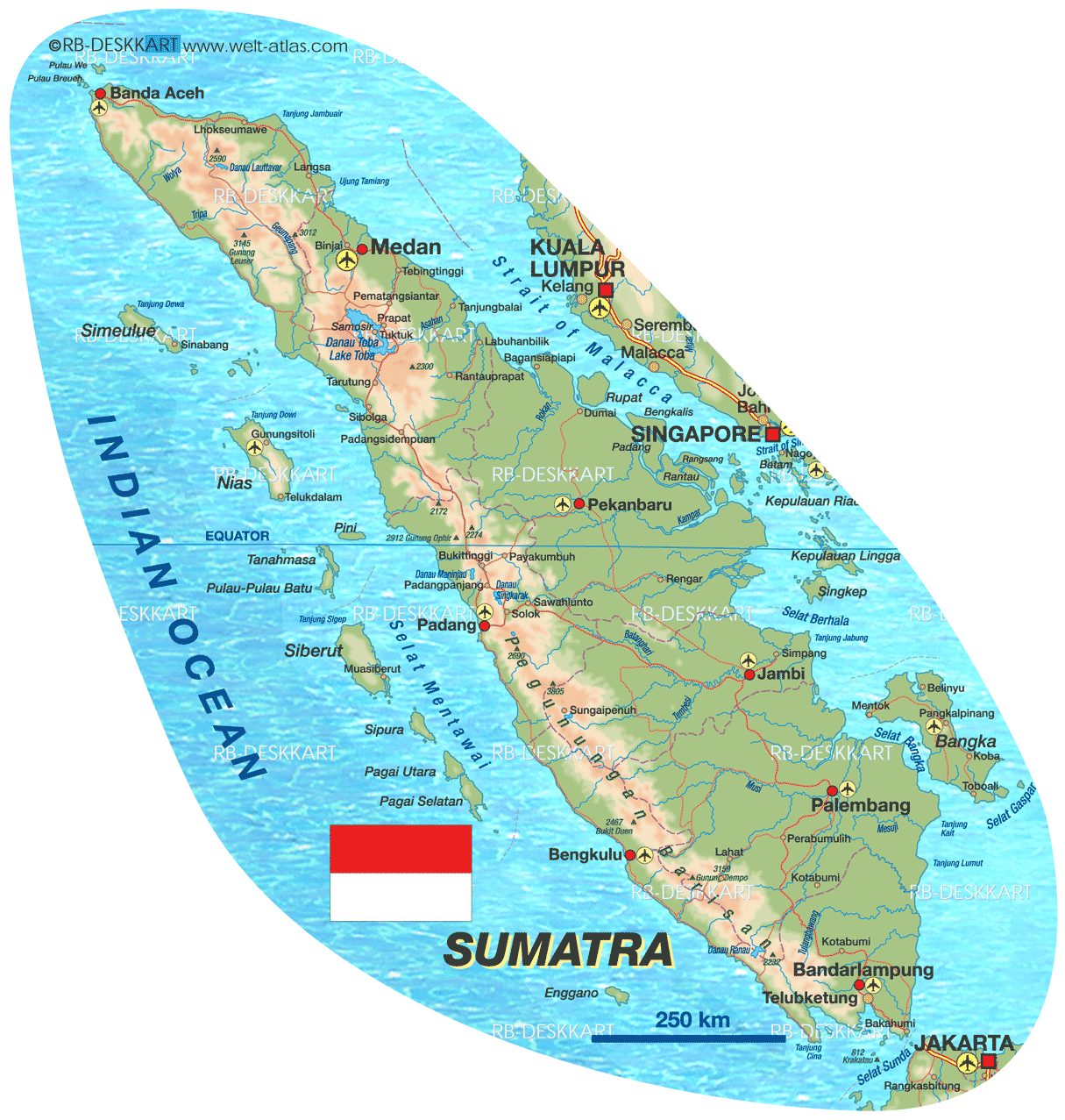
As I mentioned in the last post, Sungai Penuh, in the middle of the Kerinci Valley, is served by three roads to the wider world.  Two roads take different routes to Padang, a city of just over one million people 6-7 hours to the north.  The other road follows a tributary of the Batang Hari river south out of the valley towards Bangko and on further to Sarolangun and Jambi, 11 hours away to the east of Sungai Penuh.  The Bukit Barisan mountains, which form a spine longitudinally down the western side of Sumatra, are the major obstacle.  These mountains make it difficult to get in or out of the valley and this is what has spurred the call for new roads to link up "isolated" areas like Lempur village.  So as you can imagine, with only three roads in or out, if one of them is put out of commission for some reason or another, commercial havoc is wrought on the denizens of the valley.

This is exactly what happened a couple of days ago.  The floods, exacerbated by the longer-than-normal dry season (1), triggered several longsors or mudflows, one of which completely blocked one of the routes to Padang (known locally as the Tapan road).  Normally this road is used mainly by truck traffic delivering goods (including gasoline) from Padang in the north and the port at Painan on the west coast.  The longsor covered the road, and so for the past few days gasoline has been in short supply.  I noticed it first when I went down to Lempur on Saturday: a line of cars and trucks extending for probably 300 meters in either direction from the Pertamina (2) station in south Sungai Penuh.  I'd never seen anything like it; the only thing that comes close is pictures of fuel lines in the US in the early 1970s caused by the OPEC oil embargo.

Traffic snarl caused by line at the Pertamina
Pertamina with Pit-bound profiteer in foreground
This morning the story was the same.  I didn't want to face the crowd, but I was down to my reserve tank, and to me it's always good to have a full-tank when you're in a foreign country, so after the two meetings I had scheduled were cancelled because the meetee didn't show I made my way up the hill to another Pertamina.  Motorcycles and stepthroughs swarmed around the lone pump like worker bees on the queen, while scores of cars and trucks queued up.  Then from across the street I spied a roadside gasoline stall.  These are common in Indonesia as Pertaminas are sometimes few and far between.  Trucking and bartering in a way that would make Adam Smith proud, small-time entrepreneurs fill jerry cans with gas to sell to passing motorists.  I usually avoid them because I worry about impurities in the gas, but today the convenience was too much to resist.  Normally gas is about .59 cents a litre, or $2.25 or so a gallon in Indonesia.  You generally pay a bit of a premium on the roadside, but today the price was 10,000 rupiah per litre; about $1.10, or $4.16 a gallon.  This is a four-fold jump in the price of gas.  Friends told me that in some places the price was as high as 20,000 rupiah per liter.  I didn't want to wait around, so I forked over 50,000 rupiah for 5 liters, made some snide remarks about the special hell waiting for profiteers and gougers, and kabured.  I did take the opportunity to make some pictures and talk to some of the folks waiting.  One gentleman told me he had been there an hour already, and it looked like he had at least another hour to go.  He also told me that they are rationing gas at this point, so you can't get a full tank.

The reason I'm writing this post is because I think the road advocates will use the fuel shortage as support for the position that a new road is needed.  What better proof could you ask for?  It's especially timely since the investigative team I mentioned in the previous post is currently examining the proposed roads.  All it takes is one landslide to cripple the economy of the valley; think of all the productive hours lost while civil servants wait in line at the pumps (3).  Now imagine what would happen if the local volcano erupted, covering one of the existing roads in lava or lahar while thousands attempted to flee the valley.

But there's another side to the debate.  Though it's hard to prove at this point, the longsor that closed the road was most likely due to a) deforestation, b) poor engineering, or c) a combination of the two.  I've written previously on how cutting down trees undermines the stability of slopes.  Trees have extensive root systems which help to anchor the ground in place.  Cut down the trees and you lose the anchors.  Trees are especially important in tropical places (like Indonesia) where there is a lot of rain.  For some insight into the second possibility, have a look at the picture to the left.  I took this photo of a road cut on the way to Lempur last Saturday.  Look how steep the slope is.  There's no buttressing or anything else to add stability.  As you can see, erosion has already started, though the cut is only a year or so old.  These types of things are common around here, and the result is pretty predictable.  Shear stress eventually exceeds shear strength, and it all comes tumbling down.

So is the answer more roads, or is it more money and better engineering?  I don't know the answer to that question, but for the time being it looks like the former is going to win out. 

NOTES

(1)  When the ground is dry less water is able to infiltrate (seep down into the ground).  Once the ground is a little bit moist it is much more permeable.  So very dry ground often makes flooding worse.  

(2)  Pertamina is the state-owned petroleum company; most if not all gas stations in Indonesia are Pertamina stations. 

(3) 


Saturday, November 5, 2011

Road Construction and Kerinci Seblat National Park Part 1

Picture from Rapid Response Facility
In past posts I've focused on some of the threats to Kerinci Seblat National Park, including encroaching farmers and illegal logging.  Road construction is another major problem confronting the park's managers.  Currently there are no less than 32 proposed road projects that would cut through the park.  Over the next couple of posts I'll be talking about the proposed roads.  Each of these potential roads would have significant impacts on Kerinci Seblat National Park, ranging from direct impacts on flora, fauna, and ecosystems to more indirect and systemic impacts on the environmental services provided by the park.  These roads are emblematic of the preservation/development dichotomy inherent in national parks; you can have one or the other but not both.  Today's post focuses on one project in particular: the 40 kilometer road that would link Lempur village in Kerinci district (Jambi province) to Sungai Ipuh in Mukomuko district (Bengkulu province.  In the next post I'll discuss why roads are such a threat to conservation areas in general.

Roads for Development...

After the fall of President Suharto in 1998 significant power was devolved to district (kabupaten) governments.  At the same time, the districts were tasked with the responsibility of increasing locally generated revenue to pay for government programs.  For district governments the most popular way of increasing revenue is through infrastructure development.  The idea is that the more roads you have the more open and connected the district will be, and thus development will increase through trading and investment.  Roads and other infrastructural projects are also very visible projects; political leaders can refer to kilometers of roads built when they seek re-election.  The problem for the 15 districts and administrative municipalities around Kerinci Seblat National Park is that national law prevents them from building roads through the park.  This hasn't stopped road planning, though; currently at least eight of the 15 districts and municipalities have road proposals on the table. 

There are lots of justifications for roads ranging from opening up "isolated" villages to development of the tourism sector.  Though traditional pro-road arguments mainly focus on economic development, since the devastating earthquake that hit Padang in 2009 the most powerful and prevalent justification is that additional evacuation routes are needed.  On the surface the disaster argument is compelling; Kerinci district is hoe to Gunung Kerinci, a very active volcano.  However there are real questions as to the appropriateness of proposed routes in terms of disaster mitigation.  Given all of these justifications, the park is seen by many as an obstacle in the way of development.  All of this taken together means that roads are a very political issue here.  Support for roads comes from members of parliament and provincial governors on down to district headmen and the local people themselves.  The park is supported by a few local and international NGOs, but for the most part local people seem to be in favor of the roads (1).  It is easy to understand why if we look at the map of the park above (2).  The park is shown in red.  The enclave in the middle is Kerinci valley.  Roads are shown with dotted lines.  As you can see, there are only three routes into the valley.  You have to cross over the mountains to get anywhere, and it takes a long time to get to the closest big cities (about 7 hours to Padang, 250km, 11 hours to Jambi, 450km).  In addition, the physical shape of the park makes it difficult to go from one side of Sumatra to the other.

On the other hand, the park contains irreplaceable natural resources, protects endangered species, provides environmental services for millions, and sequesters an enormous amount of carbon, which helps to slow global warming.  Constructing roads through the park undermines its ability to do all of these things. 

Recently an "independent" team was dispatched by the Ministry of Forestry to study three of the proposed roads.  Members of the team were drawn from the national research bureau (LIPI), the Ministry of Environmental Health, two regional universities (University of Jambi and University of Bengkulu) and the Ministry of Forestry itself.  The team's first stop was in Lempur, where a proposed road linking Kerinci district to Mukomuko district has caused quite a controversy between the development and conservation camps.

A Visit to Lempur...

The end of "bikeable" road...
I wanted to check out the Lempur site first hand, so this morning I hopped on my honda and made a damp one-and-a-half hour trek down to the village.  My first stop was the forest path itself.  At the end of the bikeable road I met a farmer working in his chili field.  He guided me up the path through the forest for about a kilometer.  We passed a well-built bridge constructed approximately 7 years ago, which indicates that the road dispute has been simmering for a long time.  He told me that this area had been widened by heavy equipment several years ago and the "road" continued in this condition for about 5 km before giving way to a footpath which continues all the way to Sungai Ipuh in Mukomuko district.  Although all the forest in this area is secondary growth, I was amazed at how alive the forest was; I heard birds I'd never heard before.  The farmer told me the path is about 40 kilometers, and from time to time people make the trek to Mukomuko on foot.  He was in favor of the road project because it would improve "development".  He told me that his land is adat (3) land, and that customary adat law covers all the land between Lempur and Sungai Ipuh.  This is an important consideration as we'll see in the next post; TNKS officials and conservation advocates argue that a new road would be plagued by forest encroachment on either side.  Locals insist that adat custom would prevent encroachment. 

When I got back to Lempur village I started looking around for a couple of people that one of my collaborators suggested I talk to.  Some local folks directed me to an area behind the mosque, where I walked right into a ritual buffalo slaughter.  This event takes place once a year, and the gathering was an excellent opportunity to get some opinions about the proposed road. 

Everyone I talked to there supports the road.  It's easy to understand why; Lempur is situated at the end of a finger of valley that extends out of the main Kerinci valley, about 15 kilometers off the main road.  Most of the people in the area are farmers, for whom one of the most important considerations is access to markets.  The people of Lempur feel that if a road was opened up they could get their goods to Sungai Ipuh, which is on the other side of the Bukit Barisan mountains.  Currently it takes about a day to get to Sungai Ipuh (though to be fair there are a lot of alternative markets on the way); with a new road the time would be cut to an hour.  The people argue that they have historic cultural ties with the people in Sungai Ipuh; they say they speak the same language and have family connections there.  Moreover they feel that the park doesn't care about their livelihood needs.  One adat leader told me that before the park was created people were farming in the area; after the park was established those people lost their livelihoods with little or no compensation.  The locals claim that they are willing to compromise and cooperate with the park.  They also claim that if the road was opened there would be no need to worry about illegal logging or cultivation along the road.  Currently they feel they are at a "dead end" both literally and figuratively; they are at the very end of the road with no where to go while at the same time they say prospects for "development" are limited.

As you can see it's a tough situation.  Unfortunately the way we live our lives coupled with the constraints of geography forces us to pick winners and losers.  We have to choose between conservation and development.  In the next post I'll talk more about exactly what we lose when we build roads.  


Notes

(1)  This is due in no small part to local politicians portraying the park as an "enemy" to development; look for a future post on this very important topic.


(2)  Sorry about the crappy map; arcgis for some reason stopped working on my laptop, so this is the first time i've ever used globalmapper.


(3)  Adat refers to various local traditional codes governing, among other things, land use.

Saturday, October 29, 2011

The Temples of Muaro Jambi and the Malayu Kingdom


This past week I made the 12-hour (one way!) journey to Jambi city, the capital of Jambi province, to handle some business related to my research project.  While there I had the opportunity to visit the Mahayana buddhist temple complex at Muaro Jambi, about 20km from the city.  The temples here were constructed between the 7th and 13th centuries and represent the largest temple complex in Indonesia, covering 2,612 hectares.  The complex spreads for 7.5 kilometers along the banks of the Batang Hari river and is still being excavated.   I spent about 5 hours wandering around the expansive complex, and I would recommend the trip to anyone.  

Go To Muaro Jambi

Guide Wawan beneath the Bodhi tree
There are two ways to get to Muaro Jambi: by boat and by road.  The latter is the quickest and cheapest if you are alone.  For rp40,000 (about US$4.50) I hired an ojek to drive me to the complex.  I didn't dicker with him, but if you feel the need you could probably talk the price down a bit.  It took about 25 minutes to get there.  You can hire a boat just downstream of the WTC mall in Jambi city.  The "captain" quoted me a price of rp300,000 (around US$33) to go and come back in his motorized longboat.  It takes between 1.5 and 2 hours to go.  I didn't go by boat because the sun looked pretty oppressive and I didn't want to get burned.  But I would think that taking a boat would be fun and you could probably talk down the price a bit.   

Guides Wawan and Ahok describing temple architecture
Candi Tinggi
The entrance fee to the temple complex is rp3000 (about 35 cents).  I told the guys there they should jack the price up, especially for foreigners, so when you go if the price is higher you can blame me.  They told me that at this point they are more interested with getting the word out about the temples; they were more concerned with ensuring that I had a good time there so I would tell other people about it.  You can hire a guide there at the gate; I would highly recommend this as they are very well informed.  I tried to stump them, asking questions about the soil and hydrology of the area as it related to the original occupants of the site, and they knew everything.  I really learned a lot from them and was impressed with their knowledge.  They don't have a set fee, but I ended up paying them rp150,000 (about US$18) to split two ways, but this included transport back to Jambi city.  They motored me to some of the more remote sites and gave me coffee.  They also have a small (but nice) museum with artifacts and interpretive materials in English.  

They also have bicycles in good condition for rent; you can get one for rp5000 (55 cents) per hour.  There are tandem bicycles as well.  Though I didn't do this because I was walking with the guides, but it looks like it would be fun.  The local folks have done a great job in maintaining brick and concrete paths around the temples, so I would imagine you could pass a very relaxing couple of hours biking around.  It's quite and clean and the people are very hospitable.  

Map from Tjoa-Bonatz et al; see references and note embedded citation

About the Temples...

Tjoa-Bonatz (see references)
The complex is said to be one of the most expansive and best preserved in all of Southeast Asia.  In fact, work is ongoing, and I had a chance to witness the work first hand.  One of the larger temples was just restored last year, and a smaller structure was finished in August.  Currently dozens of local people are employed by the Indonesian government to clear away the alluvium that has piled up around the structures.  As you can see, there is a lot of work to be done.  It's really exciting to watch the process and think about what sorts of treasures may be waiting just beneath the ground; there is a real air of discovery at the site. 

Eight temples have been reconstructed so far, and according to the guides there are 84 known temples, but there is no doubt that others remain to be discovered.  All the temples are built of bricks made from the local clay.  While the temples aren't as elaborate in terms of embellishments as those at Angkor Wat and Borobudur, I would attribute this to material constraints rather than a lack of sophistication.  At Borodudur there is plenty of volcanic rock available, which can be carved to make sculptures.  Muaro Jambi, in contrast, is in a floodplain, and so clay is the most readily available material.  Some statues have been unearthed, but these appear to have been transported from Java a thousand years ago.   

One of the houses, drawing from Tjoa-Bonatz
Another interesting feature of the complex is the existence of canals that link the various temples.  There are 6 man-made waterways and a reservoir about the size of a football field.  These channels were used for transportation and drainage and indicate a fairly high level of hydraulic engineering.  The canals are currently overgrown, but there are plans to clear them out and possibly provide boats so that visitors can travel from temple to temple via water. 

Though the dwellings and other functional buildings (made of wood) have long since disappeared, carving discovered at the site provide an idea as to what the buildings may have looked like.   Tjoa-Bonatz et al (see references) offer an excellent analysis of the style and function of the houses.  They conclude that the drawings show buildings that may have been located at the site while it was occupied.  They also conclude, that given the variety of styles, suggest that Muaro Jambi was a multi-ethnic trading center, with people from many different regions living there.  

Who Built the Temples?

Source for this map here.
Though there is a new assertion that the complexity of the Muaro Jambi site indicates that it must have been the capital of Sri Vijaya (1), most of the literature takes for granted that the temples were built by the Malayu kingdom.  The picture is blurred by a lack of written documentation, and much of what is known about Malayu and Sri Vijaya comes from Chinese records.    The Malayu kingdom was centered on the Batang Hari river, which flows through Jambi.  Control of the river meant control of the resources coming down the river, like gold and other precious commodities from the hinterlands of Sumatra.  Apparently somewhere along the line Malayu became a vassal state of Sri Vijaya, and by the 14th century the polity centered at Muaro Jambi was in decline.  

As you can see, there's a lot to learn from the temples at Muaro Jambi.  They are definitely worth a visit.  I've included a video below from youtube to give you a better idea of what you can expect to find when you make your visit to Muaro Jambi. 


 Notes
(1)  The conventional wisdom is that Sri Vijaya was centered at Palembang. 

References

Tjoa-Bonatz, Mai Lin, J. David Neidel, and Agus Widiatmoko.  2009.  Early Architectural Images from Muara Jambi on Sumatra, Indonesia.  Asian Perspectives 48:1 pp32-55. 

Thursday, October 27, 2011

Border Troubles (Part 2)

"Perut dan Kepala kami ada di Indonesia, tetapi perut kami diisi Malaysia".  Resident of Camar Bulan, West Kalimantan, Indonesia, quoted in Kompas October 14, 2011 (1). 

In the last post I discussed nations, states, and nation states along with a brief description of how the old kingdoms in southeast Asia understood power and territory.  In today's post I'll focus a bit more on the current controversy between Indonesia and Malaysia.  As I mentioned previously the area at the center attention is on the island of Borneo, specifically west of the Malaysian state of Sarawak in the Indonesian province of West Kalimantan (2).  There have been accusations that some boundary markers in isolated border regions have been moved, resulting in the "loss" of around 4000 hectares of territory for Indonesia.

The Dispute


The issue is actually pretty complicated for a number of reasons.  One is that the villages (Tanjung Datu, Gunung Raya, Sungai Buah, Batu Aum, and Camar Bulan, to name a few) in the area are fairly isolated and hard to access.  Services like healthcare are lacking on the Indonesian side, and so in some places Indonesian citizens cross the border to buy and sell goods and go to the doctor.  They've been doing this for a long time now.  For example, in Camar Bulan on the Indonesian side, residents have to travel for hours to get to the nearest market town in Indonesia.  The trip is expensive (more than rp400,000 or around US$50) and is contingent on tidal conditions.  On the other hand, it's much easier to cross the border into Malaysia.  Goods like rice and gas are much cheaper there as well.  But the government of Indonesia is particularly sensitive to areas lagging in terms of economic and human development; "left-behind" areas are sometimes the targets of special campaigns and programs.  The "left-behind" areas along the border draw attention because the people on the Malaysian side are relatively better off.  You might conclude that this gives the government of Indonesia an inferiority complex.  There have even been suggestions that the people in the area might decide to switch nationalities, which some Indonesians see as a real threat to the security of the nation.

However, as I mentioned previously, the border between Sarawak and Kalimantan is relatively new, having been decided by the Dutch and English colonial authorities in the 1800s.  Even at that time, though, the border was ambiguous.  The Dutch and English agreed to use natural landmarks, ridgelines, and watersheds to demarcate the border.  But these natural features change, and so over the years the "line" has become more of a "zone".  Not that it matters to the local people, though; most of them share the same language and culture, and many have families ties across the line.  Most of the people there don't seem to feel any sort of threat; one local resident quoted in the Indonesian paper-of-record Kompas said "Biar saja...itu urusan orang Jakarta dan KL.  Kita di sini damai saja":  "Oh well.  That's between the folks in Jakarta and K[uala] L[umpur] (the national capitals of Indonesia and Malaysia, respectively).  We here are getting along fine".  In fact, many Indonesians around the border are afraid that if tensions escalate, the border will be closed and they will lose access to a closer and cheaper market. 

The Indonesian government has taken a firm stance on this issue.  A spokesman for president Susilo Bambang Yudhoyo said that the government would not tolerate any actions that intrude on sovereignty.  At the same time they make sure to point out the lack of evidence that any border markers have in fact been moved.  There's more sabre-rattling in the Indonesian parliament (DPR), though.  One member claims to have proof that the markers were moved and warns that Indonesia must be prepared to go to war to protect its sacred sovereignty. On the other side of the border the language isn't as heated; the Malaysian papers cover the dispute but it doesn't seem to be front page news like it is here. 

The Geography of Borders

In the past geographers have been very concerned with borders and boundaries because the arrangement of states, including its location in relation to other states and the length/vulnerability of the border were very important for appraising the "security" of the state.  In many cases geographers have played key roles in the actual creation of borders; for example, American geographer Isaiah Bowman served as President Woodrow Wilson's adviser at the negotiations for the Treaty of Versailles at the end of World War I.  In this capacity he actually redrew the boundaries of Europe in the aftermath of the great conflagration; Bowman and others at Versailles actually created countries by the mere stroke of a pen.  Borders have been seen as "permitting a spatial approach to international or global politics by setting out the location of states and their absolute and relative distances from each other" (Starr, 2006).  It has also been suggested (Herz) that humans organize society in the way that will best protect them from external threats.  Thus states with clear borders provide a "hard shell" against aggressors, and so there has been a natural progression towards states. 

In the latter half of the 20th century, though, geographers began to look at borders more critically.  Agnew (1994) warned of a "territorial trap" laying in wait for those that take borders too literally.  Since the 1990s many geographers (and other scholars) have suggested that borders are becoming less important in an age of globalization.  More important is the flow of goods, services, ideas, and people.  However, the Indonesia-Malaysia case (and the US-Mexico border) shows us that borders and boundaries are still important.  The important question is why?  Arjun Appadurai writes that borders are important because they highlight the differences (and often the incompatibilities) between static nation-states and the "life-worlds constituted by relatively stable associations, relatively known and shared histories, and collectively traversed and legible spaces and places".  What he means by this is that the people on the ground, and the folks at Camar Bulan are a good example of this, have patterns of making a living that exist independently from the border; to them the border only becomes important when there is a dispute between the states.  It's interesting that the border is most important to those that live farthest away from it!

Other geographers describe how borders and boundaries are an important part of the way we organize the world.  The University of Hawai'i's own Reece Jones (2008) describes how borders are cognitive tools.  However, if we read too much into them, "the fluid and permeable boundaries of the categories...gain the appearance of fixity and permanence".  Newman and Passi (1998) use the term "pedagogy of space" to explain how our experiences in school and with the media shape how we think about territory; these institutions are an important part of the "ideological reproduction of the state".  This is fancy university-speak, but it means that schools, the mass media, and other institutions are all part of how our view of our own "nation" is shaped.  We learn from maps, teachers, news reports.  I really think there's something to this; as a youngster I remember being enamored with maps because they were a really powerful way of presenting information, and if you think about it, there are a lot of assumptions inherent in maps. 

Imagined Communities?

So back to the case of Indonesia.  I mentioned in the last post that "Indonesia" hasn't always existed.  Before independence was declared, it was never a "state".  There was never a single "Indonesian people"; rather there were (and still are) scores of groups spread across the island with different histories, traditions, and even languages.  One of the only things uniting these disparate groups was the common experience of colonialism under the Dutch.  Thus when the founding fathers of Indonesia set about to form a state, they faced the challenge of uniting all these groups and fostering a common identity.  The Indonesian language is part of this.  It was declared the "national language" early on, despite the fact that it wasn't the most widely spoken language in the islands. 

For Indonesia the early-going was a little rough.  There were significant separatist pressures in the 1950s and the future of the nation was by no means certain.  The central government was faced with rebellions and other centrifugal pressures.  But eventually, as years passed, "Indonesianess" was created, and today is pretty strong.  Along the way, though, obstacles to the goal of creating national identity were seen as threats.  This is probably part of the reason why Indonesia is so sensitive about its borders.  Indonesia scholar Benedict Anderson, in his landmark book "Imagined Communities" (1983) describes how states form identities, and how we feel a connection to people we've never met just because we hold a common passport.  To Anderson "nationality" creates the illusion of togetherness.  This illusion is very powerful and useful to the central government, which will go to great length to preserve the illusion.  So in Indonesia, protecting "Indonesia" becomes a national priority, and border conflicts get a lot of attention.  Many analysts suggest that the government intentionally inflates the importance of border disputes to distract attention away from its failure to tackle problems such as corruption, poverty, and poor infrastructure.

As a neutral observer, I have no comment on this last point :).


Notes

(1)  "Our heads and stomachs are in Indonesia but our stomachs are filled by Malaysia".

(2)  Indonesians call Borneo "Kalimantan"

References

Newman, David, and Anssi Paasi.  1998.  Fences and Neighbors in the Postmodern World: Boundary Narratives in Political Geography.  Progress in Human Geography 22:2 pp186-207.

Starr, Harvey.  2006.  International Borders: What Are They, What They Mean, and Why We Should Care.  SAIS Review 26:1 pp3-10