Well, another morning back in Hawai'i working on funding proposals and reports. That sort of stuff is pretty boring, but I do have time to take a break and tell you about a very interesting person and his organization in Indonesia. The person is my good friend John Taylor. We met about 3 years ago in Jogjakarta while studying Indonesian. John is an urban planner, this means that he is interested in the layout of cities and other public places and the actual geography of living. One of the most important roles of urban planners is to work with the public to identify community goals and then to help bring together community resources, like organizations, elected officials, and residents, to achieve those goals. A remarkable things about John is that he looks for ways in which his professional skills can improve the lives of others. Towards that end, John founded a non-government organization (1) in the city of Solo (also known as Surakarta) in Indonesia.
John's NGO is called Solo Kota Kita, which means Our City Solo. The name gives you an idea of what the organization is about. You can check out Solo Kota Kita here. I had the opportunity to visit SKK's office in Solo and chat with some of the folks that work there last time I was in Indonesia, and I was really impressed with the kinds of work they are doing. The overall goal is to help residents of communities in Solo understand the strengths of their communities so that they can work together and overcome challenges. Solo Kota Kita is about empowering local people so that they can understand what resources are available to them. This in turn strengthens the community and encourages people to work together to solve everyday problems. Solo Kota Kita gathers information from planning documents, the statistics bureau, and census documents and compiles them into easy-to-understand maps (mini-atlases). These mini-atlases provide information about education, sanitation, poverty, and other important aspects of community development (2). SKK also visits each of the communities to gather information directly from the residents. John told me that SKK is currently compiling photos from all of the more than 50 neighborhoods they work with in Solo, and the idea is to make a photo-essay for each one showing the unique character of each community.
Solo Kota Kita is a really dynamic and inspiring group of people. They use tools of geography everyday, including global positioning systems (GPS) and geographic information systems (GIS). GIS enables SKK to take a tremendous amount of information and present it in a way that easy for the user to understand and make comparisons. If you look at the map on SKK's homepage you can immediately start to see patterns. The best thing about it is that all of SKK's products are available for free to the public. This means that anyone can use the information and so it's truly democratic.
You can read a great article about Solo Kota Kita here.
1) A non-governmental organization (NGO) is an organization that doesn't make profit (like a business). Generally NGOs are voluntary and service-oriented and benefit the members and/or other groups in the community. NGOs are often founded to tackle community needs that are not being addressed by the government or private businesses. They do things ranging from research, information distribution, training, conservation, local organization, legal advocacy, and community service. Can you think of some examples of NGOs in Hawai'i? What kind of work do they do?
2) Download one of the mini-atlases from the SKK website. It should open up as a pdf on your computer. Use the atlas to answer the following questions:
a. What is the name of the neighborhood?
b. What are some of the advantages the neighborhood has?
c. How do you think the people in the neighborhood can benefit from these advantages?
d. What are some of the challenges the neighborhood is facing?
e. How do you think the community could work together to address these challenges?
f. What sorts of services are available in the neighborhood?
g. How do most people in the neighborhood make a living?
Pages
▼
Tuesday, November 2, 2010
Wednesday, October 27, 2010
Sending Thoughts and Prayers to Friends in Indonesia...
It's nice to see you again after a short break. I wanted to write a post today to pass along my best wishes to all the people in Indonesia in the wake of two catastrophic events, one imminent and the other potential. As we've learned from this blog, Indonesia is a very seismically active place because it sits on a subduction zone. The incredible forces within the Earth are manifested in earthquakes and volcanoes that frequently strike the archipelago.
Earlier this week an earthquake of magnitude 7.7 struck about 150 miles off the coast of Padang near the Mentawai islands. You may recall my mentioning both of these areas in previous posts. You may also recall that the city of Padang was struck by a large earthquake just over a year ago that did tremendous damage to the city. The most recent earthquake is a product of the subduction zone we've learned about. Many of these earthquakes are off-shore under the ocean, and there is always the possibility that a tsunami will be generated. Sunday's earthquake created a 3-meter (about 10 feet) tsunami. According to most recent reports, the death toll from the tsunami stands at 113 people. Hundreds of people are homeless as the tsunami struck low-lying fishing communities. Relief efforts are complicated because the Mentawai islands are somewhat isolated and hard to access. For up-to-date information in Indonesian check the Indonesian governments bureau of meteorology, climatology, and geophysics here. For up-to-date information in English check the USGS's site here.
At the same time, Gunung Merapi, Indonesia's most active volcano, is erupting. I also told you about Mt. Merapi in previous posts; it is the volcano close to Jogjakarta on the island of Java. The volcano has been expelling clouds of gas and ash every 5-10 minutes, sending deadly materials down its slopes. 13 people have been killed already. Indonesian officials have already said that this eruption is worse than the most recent eruption (2006), which killed 2 people. Fortunately, it is easier (though not easy) to predict volcanic eruptions than earthquakes, and Indonesian geologists have been warning about the eruption for a couple of weeks. Signs include inflated lava domes and landslides. When some volcanoes are getting ready to erupt, they actually swell up a little bit as they become filled with magma. Sometimes the pressure that builds up during this process is released slowly, but other times it causes an explosion, which can be devastating.
You can find information about how to help victims of these disasters at the blog linked to here. This site also features links to non-governmental organizations active in Indonesia. These organizations focus on relief and reconstruction. Let's all send our thoughts and prayers to the people that are affected by these events.
Update Oct 28: Friends at the US-Indonesia Society (www.usindo.org) suggest making donations to the following: Indonesian Red Cross: BCA Account No. 0353112233; Account name: Palang Merah
Wednesday, October 6, 2010
Find Your Way to Make a Difference
Well, today is my last day in Indonesia for this trip. I fly back to Hawai'i via Seoul, South Korea tonight. It's been a good trip, and I am already excited about coming back at the beginning of next year. Today though I want to tell you about my friend Jakob, whom I met at Wisma Bahasa. He's been kind enough to let me stay at his apartment here in Jogja. Although Jakob is from Germany, he's traveled and studied all over the world. Now he's working for the German Development Corporation (GTZ) to help improve education here in Indonesia. But this is just his latest stop. Before moving to Jakarta Jakob started a company in Ecuador (1) with one of his buddies from graduate school. The company makes and sells leather bags. But it isn't just any company....Jakob's company gets their materials locally and their bags are produced by local skilled artisans. In addition to that, Jakob and his partner invest 25% of their proceeds in a foundation they started, which funds programs to help children that don't have an opportunity to go to school because they are so poor. I talked with Jakob a bit about his company. It's called "Longo". In the Quichua language used by indigenous people in Ecuador this word is used to describe a physically and mentally strong young person, but over the years the word has come to be used in a derogatory way to refer to anything indigenous, including people, habits, and customs. In Ecuador there are some people that think indigenous people and traditional ways of living are backwards and primitive. This is similar to the problem faced by the Mentawai people I told you about last time. But tradition and culture are very important; they are part of what makes people unique. Jakob and his partner believe that culture is nothing to be ashamed of, and I agree with them. You can find out more about Jakob's foundation here.
You can find your own special way to make a difference too. In this blog I've told you about problems, but I've also told you about possibilities and opportunities. I've told you about many special people out there that are working to make the world a better place. We've learned about Ming, who is helping to save bears, Agung who works to protect birds and educate people about the value of nature, and Luduwig, who works to make sure the community is safe. I've met lots of other people too. My good friends at Wisma Bahasa, for example, are not only working to teach people about language and culture, but they also have a lot of great outreach programs and are active in several communities. Then there are my new friends at the non-government organizations, Lembaga Tumbuh Alami, WARSI, and Floral and Fauna International, who are working to improve the environment and local livelihoods.
Start out by finding out about the world. Open your eyes, because there is a lot of wonderous stuff to see out there. I've gone from the mega-city of Jakarta to the cultural heartland of Jogja to the forests and hills of Sumatra, but I've only just begun to see this beautiful country. You can chart your own course too....be an explorer.
Along the way you'll meet great people. For me there have been so many new and old friends on this trip. There's Roro, Isna, Yos Hengke, Agus, Butet, Itha, Prisca, Nurze, Kanya, and many others at Wisma Bahasa. There's also Zoe at FFI, Emma and Hamdani at LTA, and Rainal and the folks at WARSI. At Kerinci Seblat National Park I was lucky to meet Pak Naj, Yohan and Andhikata. Other friends have helped me and hosted me, like Agung, Jakob and Eleo, and John.
I'll be back here again soon, and I'll keep my blog updated, so be sure to check back. That's it for now...next time you see me I'll be surfing!
1) Can you find Ecuador on a map? Where do you think the name of the country comes from?
Tuesday, October 5, 2010
Dulce Et Decorum Est...Jakarta Style
Well my young friends, I'm back in Jakarta. I'm having a hard time typing because my gas mask keeps getting in the way. My faithful laptop is about to give up the ghost, as they say, from the fumes. Let's hope it can make it back to Hawai'i so he can be laid to rest in the land that begat him.
Yesterday I had I a nice trip over from Padang. In the morning I was able to visit KKI-WARSI, a non-governmental organization active in the areas around Kerinci Seblat National park. The KKI in KKI-WARSI stands for Komunitas Konservasi Indonesia, or Community Conservation Indonesia. WARSI is a great group of people that is working to protect forests of Indonesia by helping the people that live around the forests. They feel that one of the biggest reasons that people cut down trees is because they are so poor that they are forced to. So WARSI works to improve livelihoods and access to job opportunities. You can check out their website at http://www.warsi.or.id/. It's in Indonesian, though.
I also had a pleasant surprise on the airplane....just as I was about to board the ticket clerk found me and gave me a new boarding pass. I had been bumped up to business class! As you amble your way down life's winding path, you'll find that there are few things in life better than being bumped up to business class. Sure, you might win the lottery and all-you-can eat ice cream bars are cool, but getting moved up to the exclusive universe of limitless legroom and free drinks is pretty much the big-rock-candy-mountain of the air. I guess the folks at Lion Air read my previous blog post and were flattered at all the nice things I said about them and the free publicity. Too bad the flight was only an hour and a half. I took a picture of the seat so you can compare and contrast with the regular seat from a few posts ago.
Before I left Padang I walked around the city a bit. They have a nice black-sand beach there, but there aren't very many waves for surfing because there is another chain of islands, the Mentawais, a few miles off shore. The Mentawais are famous for a number of reasons. They have some of the best surf breaks in the world, and surfers come from far and wide for the waves. But also the Mentawais are home to a very distinctive people with a unique culture. The Mentawai people are semi-nomadic hunter-gatherers. They live in the rain forest, which provides food, medicine, and other materials to meet daily needs. The Mentawai people live in traditional dwellings called uma. These are multi-family structures made of wood, grass, and bamboo. Although the Mentawai culture is unique and fascinating, it is under pressure from outside. Missionaries have tried to convert the Mentawai to Christianity and Islam. And the government has tried to change their lifestyle so the people are more "modern". The Mentawai have been resistant to change so they can preserve their traditional lifestyle and culture, but change is evident. Native Hawaiians have faced similar problems in the past. In fact, Hula and surfing were both outlawed fir a time because they were seen as sacrilegious. Now these two things are part of the Hawaiian identity. Can you imagine life without them? The point here is that cultural differences are sometimes used to discriminate against people or belittle a certain group. It's only until later that we recognize how unique and interesting cultures are. I'll tell you about a related story tomorrow.
I also noticed a good bit of earthquake damage in Padang. Just about a year ago the city suffered a devastating earthquake measuring 7.4 on the Richter scale. It hit close to town and killed an estimated 5000 people. I've included a couple of pictures so you can see what an earthquake like that can do to a building. The damage was so devastating in part because the proximity of the quake, but the construction techniques used in Indonesia (and in many other countries) also contribute to the damage and death toll. You can see from the rebuilding picture that I've included that bricks are used extensively in construction here. If too much mortar is used between the bricks, the structures get weaker, especially against earthquakes.
Today I did some work and then walked around Jakarta until I got tired of wheeling around my Personal Breathing Apparatus (PBA). Jakarta is a giant city. It's so big that Geographers have a special name for it...we call it (and other cities like it) a megacity. Sounds pretty neat, eh? But Jakarta has a lot of problems. There are so many people here that the city government is not able to provide essential services to everyone. But people keep coming, hundreds every day. They come from other places around the country looking for opportunities. Because of a lack of housing, people have built shanties along canals, under highway bridges, and along railroad tracks. In addition, there are so many cars that the there is a semi-permanent haze over the city.
Saturday, October 2, 2010
What Makes the Tropics So Tropical?
By now you've seen me use the term "tropical" a number of times. This word is used pretty frequently...we talk about tropical weather, tropical drinks, tropical storms, and tropical diseases (YIKES!). But for Geographers the term "tropical" has a very simple meaning. It refers to the part of the globe that is between 23.5 degrees south and 23.5 degrees north of the equator (1). The equator is the imaginary line that runs east-west around the planet, like a belt. The northern boundary at 23.5 degrees north latitude is called the Tropic of Cancer, and the southern boundary at 23.5 degrees south latitude is the Tropic of Capricorn. If you have a hard time remembering this, you can tell yourself that Capricorn has more letters than Cancer, so it's heavier and therefore sinks. One important thing about the tropics is that there isn't much season variation there; there are not big differences between summer and winter. You know this from living in Hawai'i. Indonesia is like this too.
Anyway, this region is really important for a number of reasons. The tropics is the only place you can find the sun directly overhead. In Hawai'i (2) this happens twice a year. This has to do with the relationship between the Earth and the sun. Let me explain. Look at the diagram to the right. This is a simple picture of the Earth and sun. Notice that the Earth is tilted in relation to the sun. You can see this on almost any globe you look at. This tilt is very important for the seasons; if there was no tilt there wouldn't be any summer, spring, winter or fall! Also notice in the diagram that the tilt is always in the same direction relative to the sun. We call this "axial parallelism". The tilt of the Earth and the direction of the tilt don't change over the course of a human lifetime (3). Now as you can see from the second diagram, this means that different parts of the Earth have more or less exposure depending on their latitude, or how far north or south of the equator they are. This affects how long the day is. Think about it this way. We all know that one day has 24 hours, right? Wherever you go on the planet, even Indonesia, even the North Pole, one day lasts 24 hours. That means the Earth spins on its axis one time in 24 hours. Since you are standing on the Earth that means it takes you 24 hours to go around in a big circle. But the size of that circle depends on where you are standing on the Earth. You can see two circles on the second diagram. One is big and one is small. This means that the surface of the Earth is spinning faster at the big circle than at the small circle. If you are riding on the bigger circle, you cover a greater distance in the same amount of time. That's not all. As you can tell from the circle, different parts of the Earth get different amounts of sunlight. This is due to the tilt.
Now let me use some still shots I took from one of the models I used when I teach about this to show you what this means for seasons. In the first three pictures you notice the northern part of the Earth is tilted towards the sun. You should be able to locate several lines on the pictures. Which lines have the longest sections in the daylight? That's right, the ones towards the top. We already said that this means the days are longer. To illustrate the point, have a look at the Geography Giant standing on the globe. You can tell from the different pictures that when he stands closer to the North Pole, the day is longer (about 20 hours!). However, the day is really short when he's close to the South Pole (about 5 and a half hours). This is a huge difference. But when he stands on the Equator, the day is 12 hours long (and night is 12 hours too). Now we've already learned that all energy comes from the sun. The sun also makes things hot! So it makes sense that the longer the sun is out, the warmer it is. What season do you think it is in the northern part of the planet? How about the southern part?
Now let's turn the situation around and think about what happens when the Earth is tilted the other way relative to the sun. Remember what I said about the lines in the last section? Let's try that again. Which lines are longer? So where are the days longer? That's right, closer to the South Pole. When the Geography Giant stands near the North Pole, the day is short (5 hours), but when he moves near the South Pole the day is much longer (19 hours)! That's a big difference from what we just saw! Now notice how long the day is when the Geography Giant stands at the Equator...it's still 12 hours! So this shows us why there are seasons....it's because the day length, and hence the amount of energy from the sun, changes quite a bit over the course of the year. And it also tells us why there is not much seasonal variation near the tropics: because the days are almost the same length all year round, and so there is a pretty constant level of energy from the sun. In fact, because the sun always passes high in the sky in the tropics, there is a lot of energy. Not only does this energy make it warm, it also helps to evaporate a lot of water (and drive the ITCZ, remember?), which leads to lots of rain in some places. In addition, since plants like sunlight so much, there is a lot of it so lots and lots of plants can grow. The sun doesn't pass as high in the sky outside the tropics. The height also changes with the seasons. You can see an example in the picture to the left. The lower the sun is in the sky, the more of its energy is bounced off the Earth into space, making it still colder in the winter time! I'll let you think about this for a while. It might help you to use a globe. When you feel like you've got it down, try the questions I've included below.
1) "Latitude" refers to how far north or south of the equator a location is. Geographers use a special grid, called the Geographic Coordinate System, to describe places on the Earth's surface. Using just two numbers, the latitude and the "longitude" (this describes how far east or west of the Prime Meridian you are, we can give precise information about the location of anything! Can you find out the coordinates for Honolulu? How about Sungai Penuh?
2) Hawai'i is in the tropics. How can you tell this from the information you just obtained about its coordinates?
3) The tilt of the Earth and its direction do change, but these happen on cycles of about 41,000 and 26,000 years, respectively.
Friday, October 1, 2010
A Day in the Life of Sungai Penuh
I woke up, fell out of bed, and dragged the comb across my head. Found my way off the floor and had a cup, and looking up, I noticed I was late. I found my backpack and grabbed my clean shirt and made the ojek in seconds flat. This is Sungai Penuh. I'm not quite sure how many people live here, but this the regional hub for Kerinci Valley. It's a nice and quiet town and the scenery is nice. It's very distinctive because it is still relatively untouched by big-city influences. One big thing has changed since the last time I was here, though...they have the internet now. And although it's slow, it's everywhere. There are little internet stores all over town, more than I've ever seen in such a small area. And usually they are full. I have developed a theory about this...I believe that the rapid spread of the internet to remoter parts of Indonesia is due to one factor above all others: Facebook. Everyone here does Facebook; in fact, Indonesia has the second-most Facebook users on the planet.
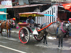
There are two ways to get around in Sungai Penuh (besides walking, of course). One is called ojek. Ojek drivers are people that have a motorcycle and will take you where you want to go for 2000 rupiah, which is about 25 cents. They are everywhere and so this is a convenient way to get around. You can see one of the ojek posts in the picture I've included. I like the sign for this one. The second way is by bendi, or horse cart. This was is a bit slower, but it's also more colorful (and sometimes smelly). It doesn't take that long to get any place because the town is relatively small. Most of the time I just walk, but since it rains about every day the ojeks and bendis come in handy. Everyone is very friendly here, and I hear "Hello Mister!" about a thousand times a day. Since there are not many foreigners through Sungai Penuh there is always someone that is eager to talk for a while. I had a nice conversation with the guys in the picture below. Believe it or not, that scooter thing they are sitting on actually runs. I call this guy the "Ayatollah of Rock and Rollah".
Today was Friday, which is the holy day for Muslims. On Fridays Muslims go to the mosque at around noon for Friday prayers. I estimate 95% of the population of this town to be Muslims, and so the streets were very lively today in the early afternoon. Most government offices shut down at noon on Friday so the workers can go to the mosque, and so today I got kicked out of the park office at 12. I walked around the town a bit and took some pictures. To the right you can see rice drying in the street. Remember I told you that this is an agricultural area, and so many of the people living in Sungai Penuh are farmers. Then I went to the market to buy a present for my friend Agung because he's been nice enough to let me stay at his place while I'm here. Then I went home, worked on my reports a bit and took a nap. I've been pleased with how much work I've been able to accomplish here. Everyone has been very helpful, and a local non-governmental-organization (NGO) has agreed to be my partner for my research. This is very important in Indonesia because it helps in obtaining the visas and research permits that are required to work here. It's also good to have a local partner because they know all about this area along with the problems and opportunities. The organization I am going to be working with when I come back here is called Lembaga Tumbuh Alami. They have a lot of great projects to help the villagers living around the park so the villagers don't have to be so dependent on resources in the park for their livelihoods. They help with economic development and also with alternative energy sources, so villagers don't have to use so much wood to cook.
In the evening there is not much to do in Sungai Penuh. Last night I rented a couple of movies. Tonight I don't have many plans. One of the big events is taking a "shower". You can see the bathroom in the picture I've included. That big concrete container is called a "bak mandi". I fill it with water that I use to flush the toilet, wash clothes, and get clean. The little green dipper is what I use to pour the water over myself. Now, you might notice that there is only one pipe coming out of the wall. That's because the water here comes at one temperature, and it ain't warm. I would go so far as to call it "bone-chillingly cold". But water is water, and it does the trick. It has the added benefit of really waking me up.
That's about it for today. Tomorrow is my last full day in Sungai Penuh; after that I take the long ride back to Padang, and then back to Jakarta. I am going to try to have some more meetings in both of those places, but for the most part my work for this trip is almost done. I've learned a great deal, but the best thing for me is that I realize that my research project is important for the people here, including those that work for the park and those that are in conflict with the park. For a researcher that's a really exciting prospect.
Wednesday, September 29, 2010
Making a Living in the Hills of Sumatra
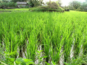
Sungai Penuh is in a valley right in the middle of two branches of the Bukit Barisan range of mountains. The valley here is extremely fertile because it is volcanic in origin. Remember what I told you a few posts back about volcanoes and soil? Kerinci valley is a good example. It's so fertile that people have been growing wet rice here for around 500 years. I've included a picture of one of the rice fields to the left. In Indonesian this type of field is called "sawah", wet rice. This is how the rice you eat begins its journey. Most people refer to this as padi or paddy rice, and it's found all over Southeast Asia and on into Bangladesh and South Asia and north into China. This type of rice is extremely productive, and it yields a lot of food in a small area. However, it is a labor intensive crop, which means it needs a lot of work. It also needs a lot of water, and so a reliable source of water is key to wet rice cultivation. In places like Indonesia you can see really extensive irrigation works which channel water from natural streams to the field. One of the most amazing places to see this is on the island of Bali, where maintainence of the Subaks (this is the Balinese word for the irrigation works) are traditionally maintained by a very complex social system. Because wet rice needs lots of people labor, and also because lots of people labor is needed to build and maintain the irrigation system, there are usually very interesting systems of rules, regulations, and community labor associated with them. Traditionally farmers have also raised fish to eat in their rice fields, but that has changed because now farmers use pesticides to kill crop pests, which makes it difficult to raise fish in the water. Why do they do this? Because it increases the amount they are able to harvest.
Wet rice is an important crop in the valley, but it doesn't grow on hillsides unless extensive systems of terraces are created (1). Here in Kerinci Valley there aren't many terraces, so people grow other crops on the hills. One is dry rice, which is a good crop, but the yield is not nearly as high as wet rice. Many farmers grow cash crops on the hills. Cash crops are things grown not to eat, but rather to be sold. Here some of the most important cash crops are tree crops. I think you can figure out what this means. One important tree crop here is cassiavera, a type of cinnamon. You can see a picture to the right. Cinnamon comes from the inside of a certain type of tree, and so the tree must be cut down to harvest the cinnamon. The cinnamon in the picture is from branches that have been cut off a tree, so the tree will continue to grow. Cinnamon originally comes from Sri Lanka. The type grown here is used mainly for cosmetics and other products.
Another important tree crop is rubber. Did you know that all the rubber in tires and shoes originates from a tree (Hevea brasiliensis)? The trees have to be "tapped", like maple syrup trees. The farmer or "tapper" cuts a slice in the tree with his knife, and the tree "bleeds" the raw material for rubber. You can see the process in the picture to the left. Usually a container of some sort is attached to the tree to collect the material. Rubber originated in South America, but was brought to Southeast Asia in the 1800s. When a virus devasted the South American trees, Southeast Asia became the world's leading producer of rubber. Sumatra is still one of the largest producers of rubber in the world. After these trees are planted they started producing rubber in 5-7 years. Rubber trees often supplement other crops planted by farmers here. This is because the price of cash crops like rubber fluctuates; sometimes is high, and sometimes it's low. When it's too low it's not worth the work to harvest the rubber, and so the trees can be left until the price increases again.
Yet another important cash crop here is shown in the picture to the right. Can you tell what this is? I'll give you a hint...it's grown on the Big Island as well. That's right, it's coffee. The coffee that adults drink is made from the bean of these bushes. Sumatran coffee is Coffea robusta, a hearty type of coffee that grows well in the climate here. Sumatran coffee is quite famous and is sold all over the world. But it is another type of commodity that is vulnerable to price fluctuations. Sometimes the price is very high, which is good for the farmers, but sometimes the price is very low, and this causes big problems for the farmers (2). So as you can see, the economy of this part of Sumatra is very dependent on cash crops. Can you think of why this might be bad for the economy? What happens if the price for all of these commodities is low at the same time? In those cases, everybody suffers. In addition, there is really only one way to make more money off of these crops: to grow more of them. That means expanding the area in which these crops are grown. And I've told you in other posts what this can lead to.
There is one other crop that is extremely important to this particular part of Sumatra: tea. Tea is generally grown on plantations, though, because you need to grow a lot of it to make any money. There is a plantation in Kerinci Valley that is one of the largest tea plantations in the world. I've got a picture of it to the left...it goes on for miles and miles! Tea from here is sold all over Indonesia and is also exported, which means it is sent to other countries as well. I'm going to be exporting some tea myself...one of my new friends gave me two one-kilogram bricks of tea (at least I hope it's tea) to take back to Hawai'i with me. Other important crops here are cabe (Indonesian for chile peppers) and patchouli, a plant that is beloved by college girls that like to listen to Bob Marley all day and wear burlap clothing.
So you can see how important agriculture is to this area. This is what the people here do, and it's what they have done for generations. It's also what their children will do. That's all for today. Why don't you think about the questions I've included below?
1. "Terraces" are used to grow wet rice on hills. The farmers cut into the mountains to make flat spaces where the rice can grow. This alters the landscape significantly, but terraces are wonderfully beautiful in some places. See if you can find some pictures on the internet. Start with "Banaue" in the Philippines. What did you find out? Where else do they have rice terraces? What other crops are grown on terraces? Check out "Machu Picchu".
2. What sorts of factors might cause the price of a commodity to go up? What might cause the price to go down?
Tuesday, September 28, 2010
Ming the Bear Man...
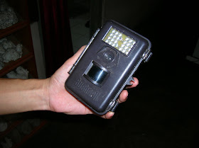
This is my new friend Ming (left) and one of his local team members, Dodi (right). Ming is a PhD student like me (but he goes to the University of Kent in the UK), and he's one of the 4 westerners in this town. Ming's project is about the sun bear (Helarctos malayanus). Ming has been based here in Sungai Penuh for a little while, but he spends a good bit of time out in the forest on the trail of the bear. Ming and his team have set up a number of special cameras in the forest. The cameras have a special infra-red sensor (like the door at the supermarket that opens automatically for you) and detect when a bear is near by and take a picture. This is called camera trapping, and is a widely-used strategy for research on wild animals. Camera traps have also been used to track Sumatran Tigers at Kerinci Seblat National Park. You can see a picture of one of these gadgets to the right. Camera traps are very effective because species like the sun bear tend to avoid humans. People make a lot of noise and smell funny (to most animals), and so the bears easily know when people are around. It's rare to see one in the wild, though one of Ming's team members has seen three of them! You may have seen the sun bear at the Honolulu Zoo. They have one. I've been to the zoo a number of times, but it always seems to be hiding when I am there.
Ming is interested in the sun bear because it is an important species in the forest. It helps with seed dispersal (like birds). They also help to break down dead trees so that they decompose more quickly and return their nutrients to the soil so that other plants can use them to grow. Although these bears are classified as carnivores (1), they mainly eat fruits and insects. They like sweet fruits like jackfruit and durian. They also appear to really like termites! The bears sleep in trees and only come down to the ground to get food. Check out the pictures from Ming's camera traps I've included below. I really am thankful he shared these with me.
Ming is really interested in how forest disturbance (2) affects the habits and patterns of these bears. Sun bears are an example of what conservationists call an umbrella species. That means that they are a good target for nature conservation efforts, because if you protect them it means that many other plants and animals are protected as well (3). In other words, the other species are protected under the umbrella of the sun bear. But in order to set up effective conservation policies and strategies, field researches have to go out and collect data about the umbrella species so they can know how much habitat the species needs and the types of food it likes. Some species require much more territory than others. For example, the Sumatran tiger needs about 50 square kilometers of habitat, and they are very territorial!
Well, that's it for this evening. See if you can answer the questions below. When you finishing you can watch the neat videos Ming shared with me of a river crossing on one of his treks into the forest.
1) Can you find out what carnivore means? What other kinds of "vores" are there? Can you think of examples of each? What kind of "vore" are you?
2) "Disturbance" is a word conservationist use to refer to changes in the forest, both natural and human-caused. For example, when a strong storm comes and blows down trees, it is a disturbance. Or when people cut the trees down. Natural disturbances are very important for the life cycle of the forest as a whole. But human-caused disturbances can be very damaging to the forest.
3) Can you think of some good umbrella species for Hawai'i? Think of both the land and the water. Why would these be umbrella species?
Monday, September 27, 2010
Paru Paru Dunia...
"Paru Paru Dunia" means "lungs of the Earth" in Indonesian. This expression is used sometimes to refer to the forests of Indonesia. This is because of the important role trees play in filtering the air. Trees and other plants are crucial for maintaining balance in the atmosphere because they take in carbon dioxide and release oxygen, and people need oxygen to live. The world is interested in the fate of the forests of Indonesia in part because of this, because this country has among the largest areas of tropical rain forest on the planet. But what exactly is a rain forest? They are areas near the equator (1) that receive very high amounts of rain throughout the year (though there are often seasonal variations). These places receive lots of rain because they are near the inter-tropical convergence zone. That's a pretty big expression, but let's see if we can figure out what it means. First, "inter-". This usually means "between" or "among", and that's what it means here. From earlier posts you should already know what "tropical" means. So we are halfway there...the first part means "between the tropics". Next "convergence". What does "converge" mean? When two things converge, what do they do? That's right, they come together. And the last word is easy. So the ITCZ is a place between the tropics where something comes together. But what comes together? The answer is simple: air. In the atmosphere the air is constantly moving. You've certainly experienced this in Hawai'i...every time you feel the wind blowing you are feeling the air move in the atmosphere. Because of the relationship between the Earth and the Sun, the places near the equator are always the closest places on the planet to the Sun (2). And what do we know about the Sun? That's right, it's hot. So it makes sense that the hottest places on the planet will be those closest to the Sun. And when air heats up, it rises. You've probably experienced this before if you've ever been in your grandparents' attic. It's always hotter in the attic than it is in the house because warm air rises. That's exactly what happens at the equator...the air rises because it is warm. As the air rises, more air has to come in to fill the space left by the rising air. This new air comes from north and south of the equator; thus it converges at the equator. There's one last thing you need to know about this. As air rises, it cools down. You've probably experienced this if you've ever gone on any of the great trails that climb up the Wainae or Ko'olau mountains on O'ahu. Or if you've ever been up on Haleakala or Mauna Kea. It's so cold up there it even snows sometimes! So as the air rises and cools down, it makes clouds. And we all know what clouds mean...RAIN! So you can see that this is a kind of cycle that is always at work, and the result of it is very consistent rainfall. I've included a cross-section diagram of how this works to the right. Geographers call this pattern "the Hadley Cell", but you don't have to remember that unless you are in the 3rd grade or higher :).
Now look at the diagram. Notice that this cycle is right at the equator. Next have a look at the rain forest map I included above. Where are most of the rain forests? Now you can understand why there is so much rain in these places. Rain is very good for plants, so the forests that grow in these places are very rich. So what's the problem? Well, the rain forests of the world are disappearing at an alarming rate. They are being cut down and burned faster than they can grow back! Have a look at the map of Borneo (3) I've included. Forest cover is represented in green on this map.
As you can see, the past 60 years has seen a dramatic loss. The same is true with other important forest "hot spots" in Indonesia, including Sumatra (where I am; see the map) and Papua. Where are the forests going? Well you may recall from a previous post that some people cut down the trees to sell, while others cut them down to grow crops to eat and sell. But there are other pressures as well. In many cases, places that are rich in forests are also rich in valuable minerals. Thus mining is another activity that causes forests to be cut down. All of these activities are good for some people in the short term, but they are bad for all the people in the long term. So why don't we just stop all the logging and mining? This is a very tough question, but part of the answer is because most of the countries where rain forests are found are relatively poor. One of the ways these nations make money is to sell raw materials, resources that are taken from the earth and later made into other things. Everything you wear, own, and want is made from raw materials of some kind, and they have to come from some place. In addition, people that are poor do not have the luxury of thinking years into the future, because they are worried about having enough to eat for dinner. And because of the importance of the inter-tropical convergence zone, these forests can't just grow anywhere. So you can see that this is a pretty difficult problem to solve; it is a uniquely geographical problem. As one local farmer said, "TNKS terkenal sebagai paru-paru dunia, tapi pada kesempatan paru-paru masyarakat yang ada desekitar kawasan TNKS terasa kempes dan sesak. Bagaimana TNKS menyikapi hal ini? Apa kontribusi yang diberikan TNKS untuk masyarakat?" Loosely translated, this means "Kerinci Seblat National park is known as the lungs of the world, but as for the lungs of the people living around the park, we feel deflated. How does the national park feel about that? What benefit does the park have for people living around it?"
Think about that for a while. How would you go about solving it? While you're thinking about it I'm going to get some sleep. You can email me some of your ideas!
1) Can you find the equator on a map or globe?
2) You might be able to make a simple model of the Earth-Sun relationship with a lightbulb and a globe. If you have a globe, you will notice that it is tilted (at an angle of about 23.5 degrees). This is because, in relation to the Sun, the Earth is tilted in space! This is very important for the changing seasons. What else can you notice about the Earth-Sun relationship?
3) Borneo is a large island in the Indonesian archipelago (chain of islands...Hawai'i is an archipelago). Most of Borneo is part of Indonesia, but part of it is part of the nation of Malaysia, and there is another small country called Brunei on Borneo as well.
Now look at the diagram. Notice that this cycle is right at the equator. Next have a look at the rain forest map I included above. Where are most of the rain forests? Now you can understand why there is so much rain in these places. Rain is very good for plants, so the forests that grow in these places are very rich. So what's the problem? Well, the rain forests of the world are disappearing at an alarming rate. They are being cut down and burned faster than they can grow back! Have a look at the map of Borneo (3) I've included. Forest cover is represented in green on this map.
As you can see, the past 60 years has seen a dramatic loss. The same is true with other important forest "hot spots" in Indonesia, including Sumatra (where I am; see the map) and Papua. Where are the forests going? Well you may recall from a previous post that some people cut down the trees to sell, while others cut them down to grow crops to eat and sell. But there are other pressures as well. In many cases, places that are rich in forests are also rich in valuable minerals. Thus mining is another activity that causes forests to be cut down. All of these activities are good for some people in the short term, but they are bad for all the people in the long term. So why don't we just stop all the logging and mining? This is a very tough question, but part of the answer is because most of the countries where rain forests are found are relatively poor. One of the ways these nations make money is to sell raw materials, resources that are taken from the earth and later made into other things. Everything you wear, own, and want is made from raw materials of some kind, and they have to come from some place. In addition, people that are poor do not have the luxury of thinking years into the future, because they are worried about having enough to eat for dinner. And because of the importance of the inter-tropical convergence zone, these forests can't just grow anywhere. So you can see that this is a pretty difficult problem to solve; it is a uniquely geographical problem. As one local farmer said, "TNKS terkenal sebagai paru-paru dunia, tapi pada kesempatan paru-paru masyarakat yang ada desekitar kawasan TNKS terasa kempes dan sesak. Bagaimana TNKS menyikapi hal ini? Apa kontribusi yang diberikan TNKS untuk masyarakat?" Loosely translated, this means "Kerinci Seblat National park is known as the lungs of the world, but as for the lungs of the people living around the park, we feel deflated. How does the national park feel about that? What benefit does the park have for people living around it?"
Think about that for a while. How would you go about solving it? While you're thinking about it I'm going to get some sleep. You can email me some of your ideas!
1) Can you find the equator on a map or globe?
2) You might be able to make a simple model of the Earth-Sun relationship with a lightbulb and a globe. If you have a globe, you will notice that it is tilted (at an angle of about 23.5 degrees). This is because, in relation to the Sun, the Earth is tilted in space! This is very important for the changing seasons. What else can you notice about the Earth-Sun relationship?
3) Borneo is a large island in the Indonesian archipelago (chain of islands...Hawai'i is an archipelago). Most of Borneo is part of Indonesia, but part of it is part of the nation of Malaysia, and there is another small country called Brunei on Borneo as well.
Saturday, September 25, 2010
Agung the Great!
This is a picture of my friend Agung. The title is kind of a joke, because "Agung" means "great" in Indonesian. But Agung really is a pretty special person. We met about four years ago at the University. Now he works at the national park where I am doing my research project. Agung makes maps and works on conservation education. I told you a little bit about him yesterday, and today I'm going to tell you about Agung and his birds.
Agung loves birds. His hobby is birdwatching. He likes to go to the forest and find and take pictures of birds. He showed me his record book where he keeps a list of all the different birds he's seen in the wild, and there are dozens of them. Birdwatching is an example of non-consumptive use. When you consume something, you use it up. For example, when you eat food, you are consuming food. That means that it is gone and no one else can use it. Hunting is an example of consumption, because when you take an animal in the forest, no one else can use it. However, when you go birdwatching, the only thing you are taking is a picture, and so other people can enjoy the birds as well.
Sumatra in general and Kerinci Seblat National Park specifically are great places to go birdwatching. As you recall, this is a tropical location, and so there is a lot of biodiversity here, especially in the forest. Kerinci Seblat park is home to a number of endemic species. These are types of creatures that are found in a specific location, but no place else in the world. Hawai'i also has many endemic species (1). But Agung told me that the birds at Kerinci are now under increasing pressure. For a long time Kerinci has been home to the Sumatran Tiger, but there has always been a problem with tiger poaching. Many people believe that parts of the tiger's body are good for medicine. Others want to keep the tiger's beautiful fur for themselves as a decoration or rug. As a result, there are only about 300 Sumatran tigers left! It's almost extinct! But the police are getting better at stopping tiger poaching. However, the poachers are now instead taking rare birds from the forest to sell in the market. According to my friend Agung, as many as 1,000 rare birds per week are taken from the park. If this continues, the birds will be no more!
That's where Agung comes in. Agung started a birdwatching club for young people around the national park. He teaches them about how important the birds are. You see, not only are they beautiful, but they are extremely important in the life cycle of many plants, because they help to pollinate the plants and help with seed dispersal. For example, when a bird eats fruit (like the hornbill in the picture above), the bird also eats the seed of the fruit. Later, after the bird flies away, he/she poops and the seed comes out with a starter kit of fertilizer so the seed can grow into a new plant! Agung also runs training programs for tour guides and other people interested in birds. Now Agung is applying for a grant to expand the activities of his bird club so they can help track the poaching networks that operate around the park. He also wants to train the members of his club to carry out scientific bird censuses. Let's hope Agung gets his grant, because this project is really important. You can check out the blog for the birdclub at kerincibirdclub.wordpress.com. Most of the posts are in Indonesian, but there are some great pictures.
That's all for now. I'm going out into the forest tomorrow with Agung to run a training workshop for science teachers.
1) Hawai'i has some amazing endemic birds too, but many of them are endangered. See if you can find some information about Hawaiian Honeycreepers on the web. These are truly wonderful birds. What can you find out about them? What kinds of problems do they face?
2) Can you make a list with descriptions of the types of birds you see on a daily basis? How many of the birds do you see? Where do you see them? Do they seem to have any special habits? Can you find out the names of these birds?
Thursday, September 23, 2010
Into the Jungle...
Well, I'm finally out of Jogja. Now I'm on the island of Sumatra. I road on a small bus today to the site of my research project. It only took 7 hours! Last time it took 10 hours. I was very happy, because on a 10 hour bus ride it's the last three that really get to you, whereas on a 7 hour ride, it's only the last 2.
So far I've told you a great deal about Indonesia, but I haven't told you much about what I'm doing here. I'll start today by telling you a bit about the forests of Indonesia and why they are important for the rest of the world. Like I mentioned in a previous post, Indonesia is a tropical country. Since Indonesia is close to the equator it receives a lot of energy from the sun year-round. Since the sun is the source of virtually all life on earth (1), this means that Indonesia has the perfect conditions for all sorts of wonderful plants and animals to grow. As a general rule, the closer a place is to the equator, the more variety it will have in terms of plants and animals. This is referred to as biodiversity. Indonesia is a perfect illustration of this rule of thumb; it is one of the most biodiverse countries on the planet. Here you can find countless species of insects (most of them not even discovered yet!), dozens of reptiles (including the largest lizard in the world: the Komodo Dragon (2)), rhinos, tigers, elephants, and the tallest and largest flower in the world! The forests of Indonesia serve as the habitat for most of these fantastic species (as well as thousands of others).
The forests here also have other, less visible benefits as well. The forests help to counteract global warming (3) by absorbing carbon dioxide, a greenhouse gas, from the atmosphere. And they are a source of food and other materials for millions of people across these islands.They also help to prevent floods and landslides. Trees guard against flooding by slowing the rain down so it doesn't all go into the river at one time. Think about the last time you were out after the rain. What happens when you walk under a tree and the wind blows? That's right, you get wet! That's because the rainwater pools on the leaves. Some of it evaporates from the leaves, and some falls to the ground after a while. But if all the trees are cut down there is nothing to stop the water, and so the rivers rise very fast. Trees also guard against landslides because the roots of the trees help to strengthen the ground and keep it in place. Ask one of your parents or your teacher to help you with the diagram I've included. This should help you visualize how important trees are for hydrological balance (4).
But trees are also valuable as wood if they are cut down (5). In addition, many people value the land much more for farming than as forests (remember from an earlier post I said that Indonesia is an agricultural country). Thus there is incredible pressure on the forests of Indonesia from people that that would rather sell the trees for wood or as paper for pulp or cut them down to make room for new farmland. This brings up a very difficult problem. On the one hand, we understand that the forests are very important for all the services they provide. However, on the other hand we understand that people need to make a living. Nature organizations and governments have been working on this problem for a long time now, but it still hasn't been solved. One way of protecting forests is to create national parks. And that's why I'm here. I'm currently in a town called Sungai Penuh (6). This town is right in the middle of the largest national park on Sumatra, Kerinci Seblat National Park. It's almost twice the size of the Big Island! But this park faces many problems: illegal logging, road-building through the park, encroachment by farmers growing crops within the park, and the poaching of critically-endangered species like the Sumatran Tiger and Sumatran Rhinoceros. I'm here to study all of these problems and the reasons why people choose to cut down trees and poach animals. It's a tough job, though. The hardest thing is to try to find solutions that everyone will agree with.
If you've ever been hiking in Hawai'i to a place like Manoa Falls you've walked through rain forest. What do you remember about the hike? Was it wet? Humid? Were there a lot of insects? The forests of Indonesia are a lot like the forest in the back of Manoa Valley. Next time you go on a nature hike, try to think of all the benefits the forests provide. That's all for tonight. I'll try to write some more tomorrow. In the mean time, you might want to think about the questions below.
1. Nearly all life on Earth depends on the sun. This starts with plants, that use the energy of the sun to grow and make food for themselves. They are the basis of the food web. Other creatures eat plants, and they in turn are eaten by other animals. When plants and animals die, they decay, returning their nutrients to the earth. Can you work with your classmates to draw a picture of a food web for O'ahu?
2. You may have seen the Komodo Dragon at the Honolulu Zoo. How big was it?
3. Geographers prefer to use the term "climate change", but global warming is the term most people are familiar with. What do you know about global warming? Why is it bad? Do you know what causes it?
4. The prefix hydro- generally has something to do with water. So if you see a word you don't know with "hydro" in it, you might be able to guess the meaning from the context. Can you think of some words that have hydro in them? What do these words have to do with water?
5. Virtually all economic analyses of forests indicate that they are more valuable left standing for the services they provide than as wood or pulp for paper. If this is the case, why would anyone want to cut down trees? Discuss this question with your teacher and see if you can figure out the answer.
6. Can you find Sungai Penuh on a map? Try using Google Earth...